Now we have reached the end of the beautiful sailing grounds of the Chesapeake Bay and we start our first miles on the ICW. This way we are circumventing the sometimes hazardous wind and wave conditions around Cape Hatteras, a very pronounced point reaching out into the Atlantic on Hatteras Island, a large barrier island in North Carolina. The ocean waters around here are often referred to as the “Graveyard of the Atlantic” due to over 600 ships that have perished on its ever shifting sandy shoals. Turning inland, we see some spectacular scenery, not unlike some of the sailing we have done in the Great Lakes in Canada. We also get to meet some great new sailing buddies, who we will cross paths with over and over.
So what the heck is the ICW or Intra Coastal Waterway ? It’s an inland waterway system of rivers, canals and sounds that lets you travel down the Eastern Seaboard of the United States by boat and avoid travelling on the Atlantic Ocean. Its start is located in Norfolk, Virginia. Here is where you enter Mile one of the altogether more than 3000 miles of connected waterways mostly used by recreational boats. However, be aware of barges as well as some cruise ships who can unexpectedly appear around the hidden bends of narrow canals. The whole length of the ICW actually follows around the tip of Florida and along the Gulf coast to Brownsville, Texas. And we had already travelled parts of it before the official mile 1 in Norfolk, as the Cape Cod Canal in Massachusetts is part of it as well.
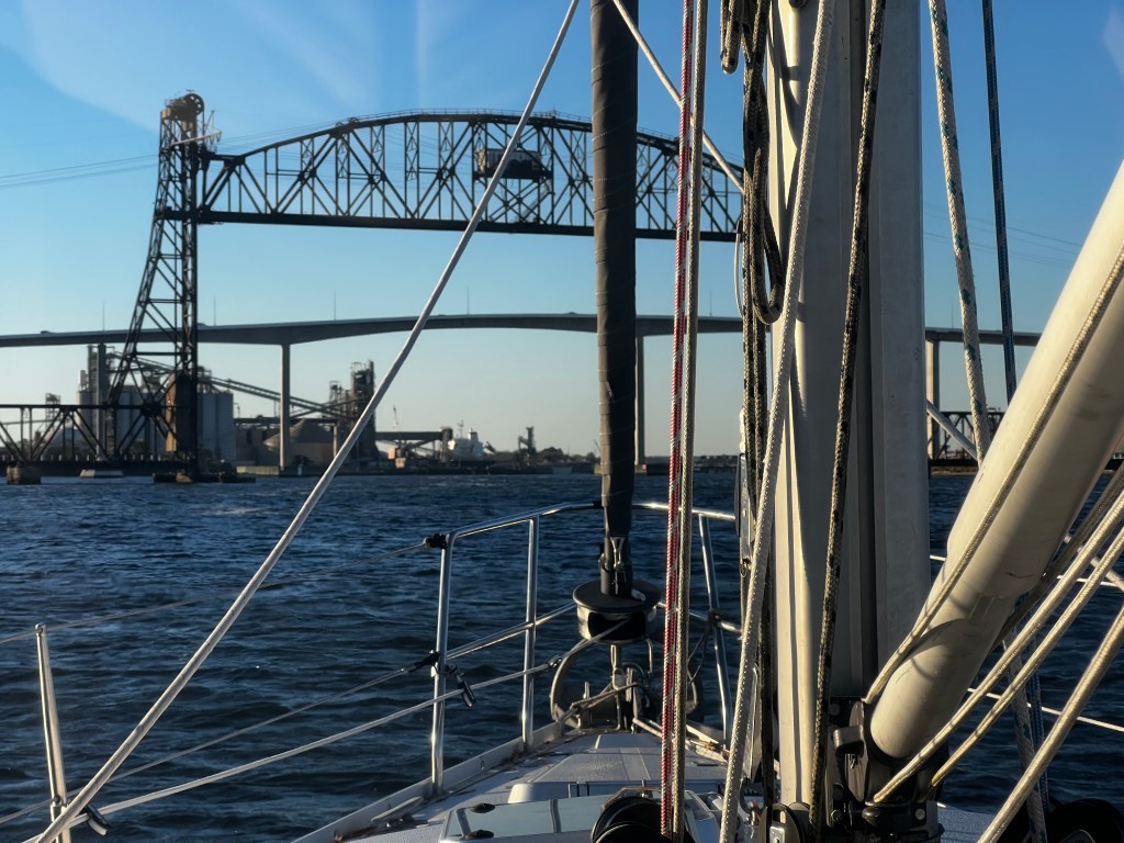
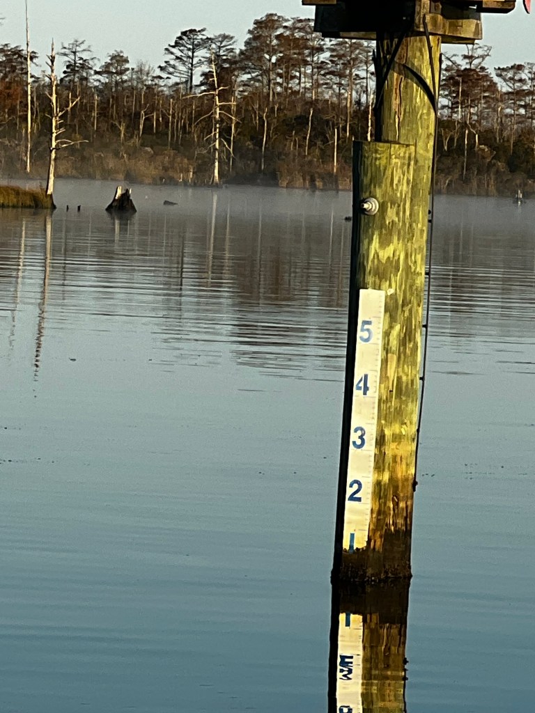
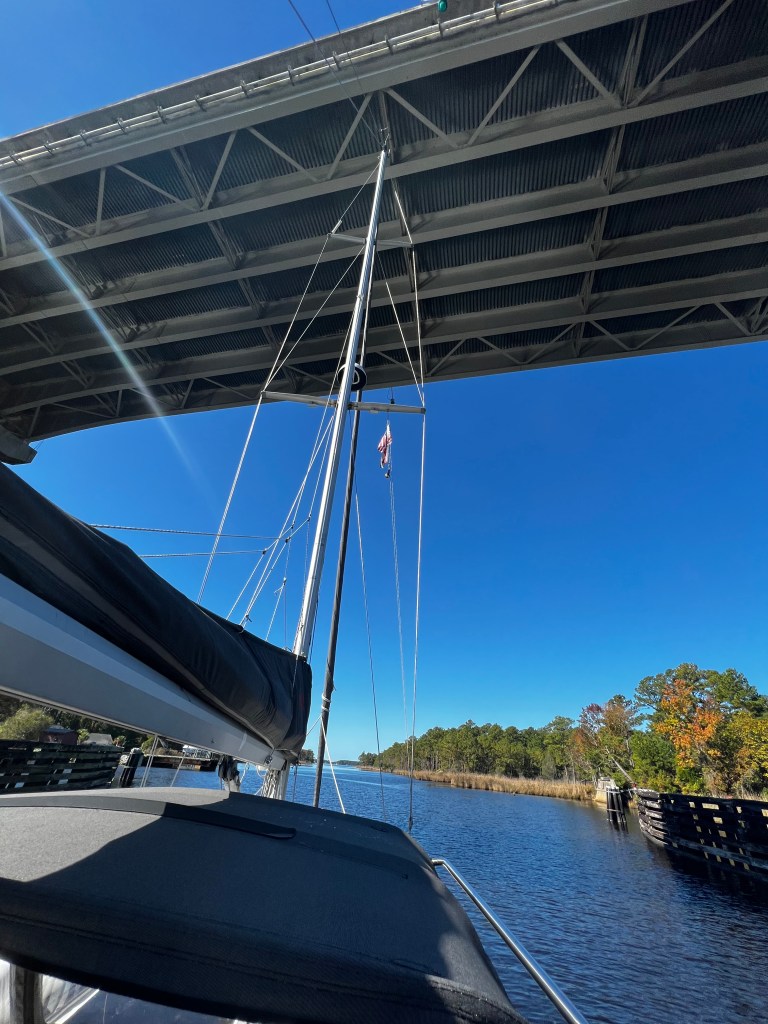
As a sailboat, we have to watch our draft – how much water do we need to safely float without grounding, but also how much air draft do we need. Yes, sailboats have tall sticks called masts that have to make it under bridges. The ICW has been modernized over the last century and all new bridges are now a minimum of 65′ or so they say. Now you can imagine that water levels might not always be the same, so depth and bridge hight can vary. Bridges are supposed to have fender boards telling you what the hight is. Here’s a picture – the higher the water level – the lower the bridge hight.
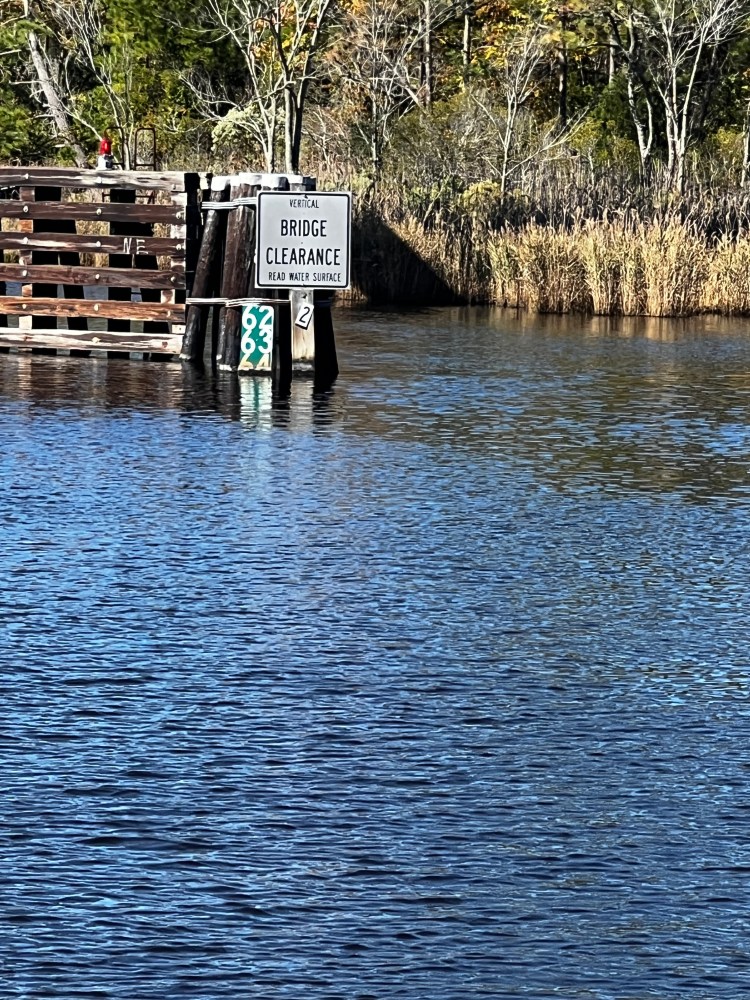
We are relative lucky. Vitae’s airdraft is 58′ from the water line plus about 3′ for extra wind instruments etc. on top of the mast. Before we entered the ICW we checked that once more to be sure, with our 100′ tape measure up the halyard. And since then we have gone through a 62′ bridge and not heard any ‘tick-tick’ sound (that’s what you hear if the top of your wifi antenna touches the bottom of the bridge. ) None-the-less, the first bridges are scary and it does take a leap of faith to go under them, but if you did your homework and know how tall your mast is you should be good.
And others aren’t as fortunate. Here’s a link to our friends Greg and Ann Streicher on SV Halekai and the determination it takes to get a slightly taller mast through a low bridge. They heeled their boat by loading all the heavy things to the port side and then suspending the dinghy with other heavy things off the boom over the port side of the boat – and it worked!
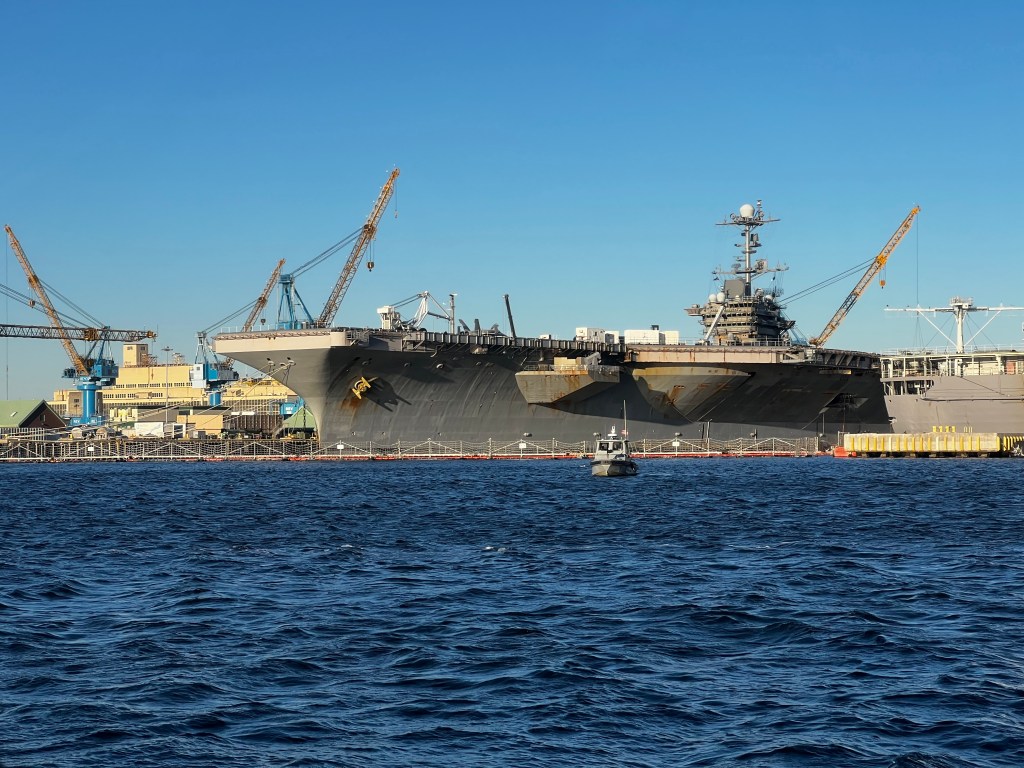
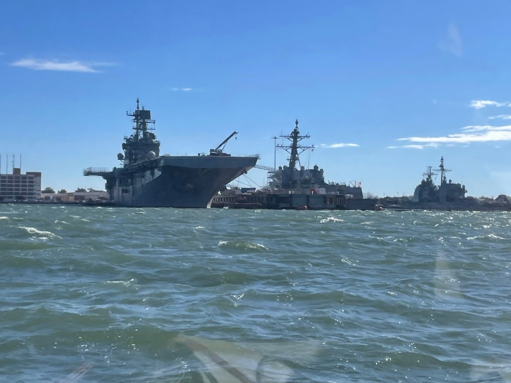
The anchorage at Phoebus had become fairly bumpy over night and we decided to jump across to the Norfolk side of Virgina entering the Elizabeth river. Seeing 25kts on our way it became much calmer as we motored by the Norfolk Naval Station Piers, the world’s largest naval station. Never had we seen so many aircraft carriers! According to Wikipedia, the US has 11 active carriers as of 2023, which is the largest fleet in the world.
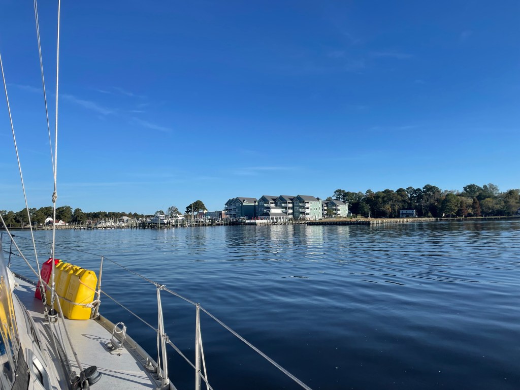
We anchored just off Hospital Point on the Portsmouth side across from Norfolk and were able to explore both sides waterfronts a little, enjoying the music that flowed across the river from the wine festival. Unfortunately, the next morning we woke to the constant blaring of “cabins 50 to 100, breakfast is now being served…” as a large cruise ship had appeared at the pier over night.

We enjoyed a quick run along the Portsmouth waterfront and after checking out the High St. free docks and seeing space, we moved our boat there. It’s just a tiny square basis, that is used by the ferry on one side but leaves enough space for up to 5 40′ boats. No floating docks but bollards meant tying longer lines and hanging fenders horizontally (there’s a 3 foot tide), but it was super calm in here. We shared the space with 2 other sailboats and felt a bit on display as tourists and locals would stroll by or take a rest on the benches. Everyone was friendly, quiet and respectful though. A 1.3 mile walk on High St. , which has a number of pubs and restaurants brought us to a Food Lion grocery store in an area that had seen better days, but we were safe enough.
We had a very quiet night at the dock and on Oct. 23 at 5:30 am, we finally started our official trip down the ICW to Florida. Our first impressions: It seemed much like a canal travel, with a lock, bridges that were 65′ and railroad bridges that were much lower, but would open at set times when requested. Of course, there was lots of traffic as boats had to wait for the lock or bridges. Not my favourite, hovering in a narrow channel, with no bow thrusters trying to keep the boat in one spot with winds, currents and other boats not helping things. Dave somehow keeps calm at the helm and I am glad I can pass that job to him. So we did 14 bridges that first day, of which 8 were opening at set times. We left the industrial areas of Norfolk behind and entered into more remote areas down the Elizabeth river and into the North river. All the boats that had passed us on the way seemed to stop at the docks at Coinjock marina. When we came by parties were in full swing. We waved and continued down the river a few more miles to tuck into a quiet corner of the river, joining one small trawler, aptly called “Be Kind”. And the owner truly was – although he had warned us that he would have a very loud generator, he opted to never run it so we could enjoy a quiet evening and early night.


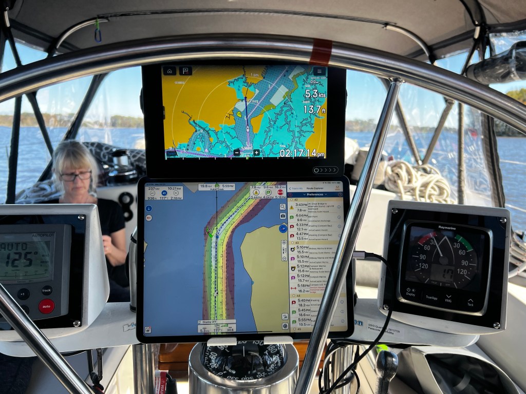
This last picture shows our new helm arrangement. We added the Aqua maps on the iPad which show the Bob 423 tracks, the continually updated routes that show shoaling on the ICW. This is the bible most boats on the ICW navigate by. The US Army Corps of Engineers is continually dredging the channels but waters are shallow, sometimes only read 6 or 7 feet and buoys can’t always be trusted due to constant Shoaling. This particular section wasn’t too bad with 11 to 12′ in the channel but shallowing to 6′ in the red area and 2′ in the blue. This would get much worse further south.
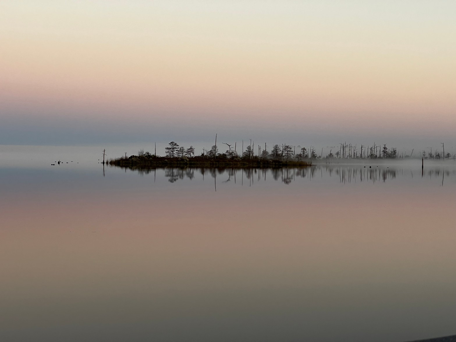
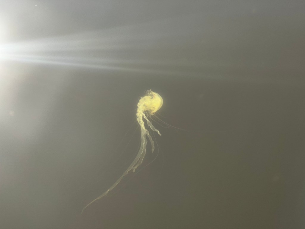
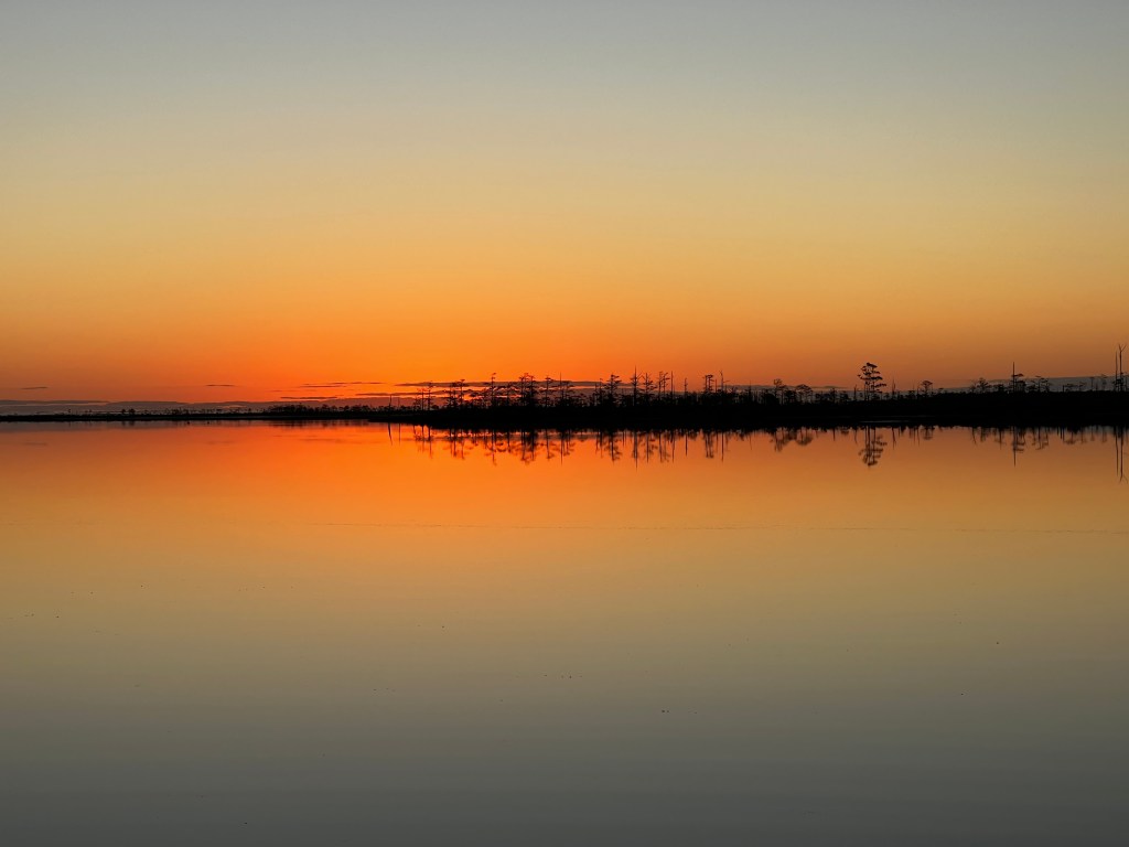
The area, however, was beautiful, sometimes going through narrow channels lined with pine trees. This was just like canoeing in eastern Ontario – at one time Dave even spotted a little Black bear on the shore. Our boat must have startled it and it scurried up a pine tree, but as soon as we had passed it was just as quick to climb back down. Yet the water was salty as it flows in from the ocean and we could see tons of jelly fish swimming around. It’s shallow and murky brown and we had no desire to swim in it.

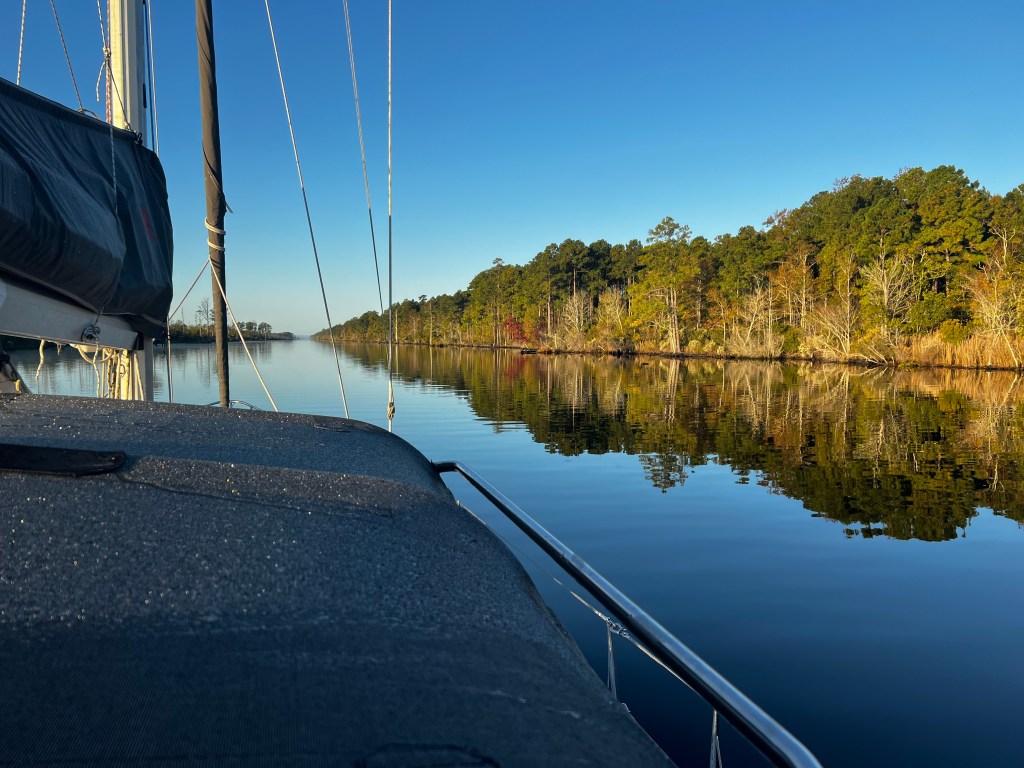

Anchoring was a little stressful at first as we had to leave the trusted Bob Tracks behind and venture off the ICW channel. We had to carefully watch our depth sensor and rely on notes of other boaters who had left hints and comments on the charts. Often we were just a stones throw out of the channel and out of the way of large barges and other faster moving boats, so having a good anchor light is essential. At other times it felt like we were the only boat in a world entirely made up of water. I never realized how the coastal parts of Virginia and North Carolina are so dominated by wetlands and rivers.
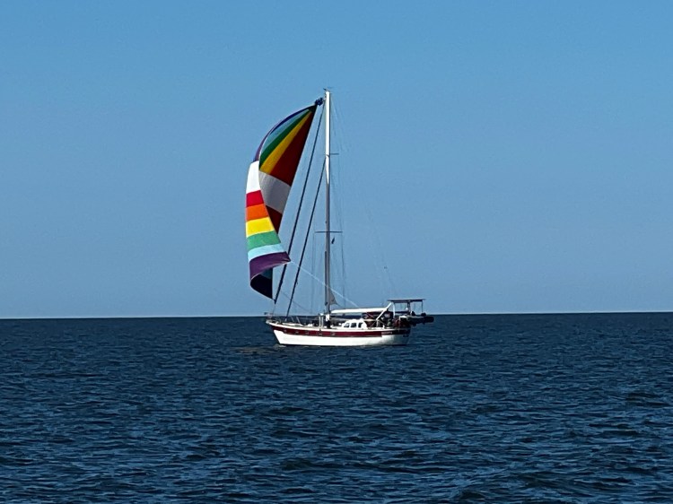
Sometimes these narrow rivers and channels would open up into a sound and depth would increase to 16′ or 20′. These sections were a welcome change as we could get the sails out and turn the motor off for a little. This is how we first met Andrew and Megan on ‘Keeper‘, a young couple from New Brunswick who had said Good Bye to life on land and were taking their beautiful 1982 Pan Oceanic 43 down to The Bahamas. What a cool boat! We had heard their boat name on the VHF before but that day we finally saw them sailing along with a rainbow coloured spinnaker. We got some nice shots of their boat and after timing some bridges together ended up in the same anchorage in Belhaven, NC.

Belhaven was a perfect stop for us as the little town had a decent grocery store, a day dock with pump out and water. We stayed a few days and had the crew from Foggy and Keeper over for pizza. There also happened to be a little brewery right by the dinghy dock aptly called the ICW Brewery and one night we met Linda and Andre from I-Boat, a French Canadian couple and Jeremy and Brittney from Willow who were live aboards in their 2nd year on the little patio watching the sunset. Together with the crews of Keeper and Foggy we really enjoyed the evening but would all be going different ways again after this, in hopes of meeting again further down the ICW or The Bahamas.
A few days later we anchored in Adam’s Creek at the Cedar Creek anchorage to get out of the choppy waters by Oriental. Seeing some big shrimp boats going into this little creek, we were hoping to buy some fresh of the boat the next day. So we got into the dinghy to explore, first going up the south arm of the creek until we hit a low bridge and decided this was far enough into Alligator country! We never saw one but it sure felt like their eyes were lurking behind every clump of reeds. On the way back we pulled in at Pittman’s Seafood, where 2 large shrimp boats were moored. Only Kenny Pittman, the owner, was around and we had a great chat with him. Unfortunately, these two shrimp boats had not gone out that day, so no fresh shrimp for us, but he told us about the migration of shrimp and that boats would now be starting to go fish them in the Atlantic instead of the inland sounds. Asked about alligators he assured us that there were many around and normally they would be right by the docks. They know when the shrimp boats come back from their catch that they get fed some of the scraps. Kenny knew all the alligators around and some he could even hand feed!
After Shane and Lori served up a great dinner followed by some games on Foggy we all decided to move on the next day. Winds had increased to 15-20kts from the NE and the anchorage was getting a bit bumpy. Slowly we motored through the Adam’s Creek Canal eventually ending up at the Ocean, in Morehead City. We parted with Foggy as they were planning on a couple nights at a marina in Beaufort, NC while we anchored behind Sugarloaf Island on the Morehead City side. We were thrilled when we saw Keeper anchored there as well. It was a choppy anchorage but we managed to take our dinghies around the north east side of the island and find a dinghy dock at South 6th street. From there we did a 2km walk west to a Lowes Food for supplies and had Megan and Andrew over for dinner after.

They were getting ready to head out into the ocean and do longer hops along the coast as Keeper’s air draft is around 64′, so it gets very tricky to get under all the bridges. Our plan was to stay on the ICW for a bit longer. The bridges were no problem for us and our 5’7″ wing keel had not been an issue with depth so far either. Well, little did we know that the next day would probably be our worst day on the entire trip so far!


It all started great. The winds were breezy from the NW about 20-25kts, sunny, and the ICW should be no problem as we were protected from the ocean swell. We had a couple 65′ bridges. However, the ominous sightings of more and more derelict boats washed up on shoals were a foreboding omen. We made decent time and had entered the area around the Marine Corps base Camp Lejeune, a 640 square kilometre United States military training area. There were warnings not to land or stop in certain areas although an anchorage is located at Mile Hammock Bay, which is were we were heading. Around 14:00h we were getting close to the next bridge at Onslow Beach which was opening at the half hour. If we sped up just a little we would be able to make it, so we foolishly threw out our jib to add a little more speed, getting us up to 7kts. We were just coming up to one of the openings to the ocean, where shoaling appears and shoals do move here! All of a sudden the boat grinds to a dead stop! What the …! Immediately, we doused the jib, reversed the engines. No luck. We threw the dinghy in and tried to push the boat turning it. She wouldn’t budge. A little fishing boat came by, but he wouldn’t even come close. He called out to us that he couldn’t help us. We were stuck right in the middle of the channel by the green 61A can where the Brown’s Inlet flows into the ICW. The shoal had moved all the way out into the channel. Thank God we had gotten a SeaTow membership, but it still took an hour for him to come out at which time our rudder started to sink into the sand, so we had no steerage and the ebbing tide was not helping. The bow of Vitae was starting to sit above the water. The guy from SeaTow was very professional and calm. First, he used his big outboards to wash the sand out from under our rudder. He took depth readings all around our boat and we were so close to 7′ of water, but our wind keel was thoroughly stuck. Pulling our stern first to get us to deeper water didn’t do it. Then he tried the bow. It took 45 minutes of pulling until Vitae finally started slowly inching across the first sand shoal and then the next. What a relief to feel the boat floating. He then towed us past the shoaled inlet and we let the tow lines go. Wow, that was a close one! Thank you SeaTow – no charge as it’s part of your membership. Our recommendation, on the ICW, don’t go without it! We had been so careful, but it happens – grounding is so common. BTW, Bob’s track for this section of the ICW was adjusted the next week, and it’s now dredged shortly after our incident as we were not the only boat to struggle here.
We had been stuck in the channel for more than 2 hours, so we were late now, still had to wait 10 min. to finally get through the last swing bridge and pulled into our anchorage at Mile Hammock Bay just before dark. Where we had a glass of wine and discussed our recent experience, and what we had learned. It all comes down to: Don’t rush! Even if you are trying to make a bridge opening – don’t ignore the areas with shoaling – go slow, follow the track. If you can do shallow sections at high water or on a flood tide so you can get off. (Of course, we didn’t get any pictures of this whole fiasco!)
We decided to stay in Mile Hammock another day to lick our wounds. There was entertainment provided by the military, running some drills in boats and a couple of Osprey aircraft. Exploring on land was of course no option as it was all military base, but we had some electrical engine issues to trouble shoot and to bend our bow roller back into shape after the tow line had done a bit of damage. Nothing Dave couldn’t fix with a hammer.
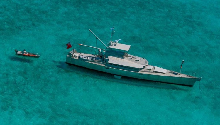
Before 8 we were on our way again the next morning – more shallow shoals and inlets, which we maneuvered slowly following Bob’s track, seeing the odd sailboat that had floundered and been abandoned along the way – sad warnings. We did a long day of motoring intensely staring at the chart plotters, which is quite tiring. The 4th bridge (the Wrightville Beach bridge was an over 30 min. wait for us with 4kts current and lots of boat traffic. After which we decided to just keep going to get out of this busy area. One more bridge and shallow area would get us to the Cape Fear River, where we could anchor far off the channel. I was at the helm and maneuvering through the last bridge which was high enough but by this time of the day, we were motoring directly into the sun. I could not see anything, so just followed the track on the charts. David was keeping a look out for traffic and visual obstacles. Slowly I steered Vitae through the bridge and then snaked her through the shallows at 4kts. Suddenly, we are being hailed: “Vitae, Vitae this is motor yacht Tiger. I am going to give you a slow pass to port.” I said to Dave – tell him no, your wife’s at the helm and she’s a bit stressed right now going through the shallows. Tell him to wait until I am past this section. To which Tiger calmly replied: “No problem, I’ll slow down and follow you until you give me the go-ahead.” “Thank you, Tiger!”.
Now I have to explain that Tiger wasn’t just any boat, but an FPB-78 – designed by Steve and Linda Dashew and built in New Zealand. These vessels are real offshore power boats which easily handle rough ocean conditions. With their unpainted aluminium hull and sleek almost mean look, they are a bit intimidating when they are bearing down on you. Steve and Linda’s story on how they developed the boat is a very interesting read.
| Date | Description | Distance | Travel time |
| Oct. 21/23 | Hampton, Virginia (Phoebus anchorage) to Portsmouth (Hospital Point anchorage) | 9.6NM | 2h |
| Oct. 22/23 | Hospital Point anchorage to High Street Landing (free dock) still in Portsmouth | .4NM | 0:19h |
| Oct. 23/23 | Portsmouth to North River, North Carolina (Public Creek north anchorage) started the ICW; 14 bridges (8 opening bridges) + Great Bridge Lock | 44.58NM | 10h |
| Oct. 24/23 | North River to Alligator River (Tuckahoe Pt. anchorage); 1 opening bridge | 43.61NM | 8:25h |
| Oct. 25/23 | Alligator River through Pungo River Canal to Belhaven anchorage; 2 bridges | 28.73NM | 5:41h |
| Oct. 26, 27/23 | stayed in Belhaven | | |
| Oct. 28/23 | Belhaven to Snode Creek anchorage | 15.46NM | 3:18h |
| Oct. 29/23 | Snode Creek to Oriental (lunch stop) to Cedar Creek anchorage (Adams Creek); 1 bridge | 30.84NM | 6:30h |
| Oct. 30/23 | stayed at Cedar Creek | ||
| Oct. 31/23 | Cedar Creek to Morehead City (Sugar Loaf anchorage); through Adams Creek Canal; 3 bridges (1 opening) | 14.86NM | 3:04h |
| Nov. 1/23 | Morehead City to Mile Hammock Bay anchorage; 3 bridges (1 opening) – grounded at can 61A | 34.79NM | 10:56h |
| Nov. 2/23 | stayed | ||
| Nov. 3/23 | Mile Hammock Bay to Cape Fear River (Orton Point anchorage); 5 bridges (2 opening) | 46.83NM | 10:15h |
| 14 days | Total | 269.7NM | 84:28h |
| 150 | Total trip so far | 2,790.72NM | 548:22h |

What an adventure and welcome to the run-aground club. We had our grounding baptism near Sorel, QC while still on the St. Lawrence, but were fortunate enough to muscle off the shoal with her own power.
LikeLike
Yup, Dan, that was definitely our worst one yet, just glad it was all soft sand. Hey, we are really enjoying hanging out with your buddy boat African Queen. Cheri and Jon are a blast and we have been travelling together since our crossing.
LikeLike
Thank you for preparing us for what is in store next season for Gaviidae!
LikeLike
Like I said, Julie, that grounding was probably the worst for us so far – but more as initial shock, bruised ego, and learning experience. Heck, if there weren’t any ‘downs’ than we wouldn’t be able to appreciate the ‘ups’! How far are you guys planning on taking Gaviidae this year?
LikeLike