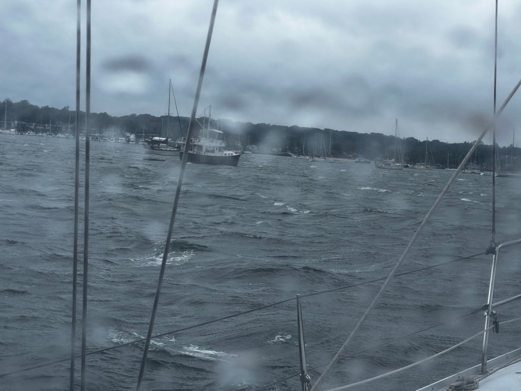
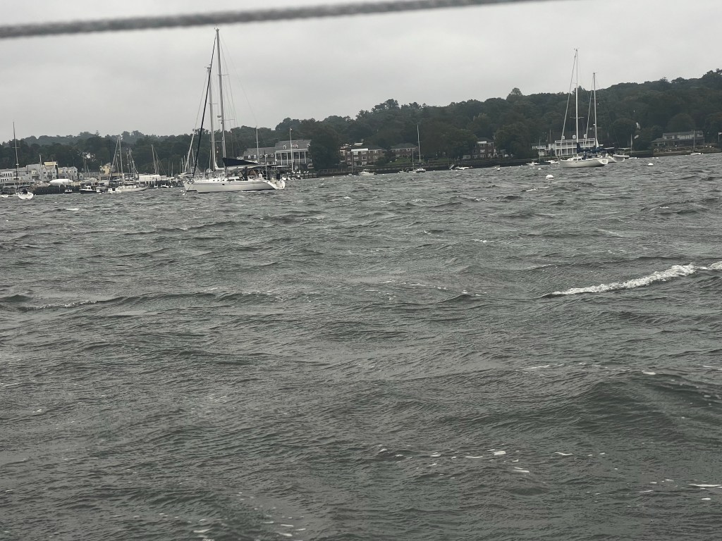
Remember what happened when we sailed into Halifax, Nova Scotia? They declared a state of emergency! It was the rainiest weekend they had seen in years and broke the record rainfall of 250mm in one day. Well, we did it again! Sailing into NYC, tropical storm Ophelia was causing strong North East winds and rain to linger over the city with record rainfalls of up to 200mm in areas, causing a state of emergency to be declared once again. They even had Sally, the sea lion, escape her enclosure in the Metropolitan Zoo. Meanwhile, we felt like trapped animals in our boat – almost a week of torrential rain and up to 36kt winds kept us boat bound in the Port Washington anchorage just north east of the Big Apple.
A year older, but surely not any wiser, I hoisted anchor the next morning and we left stinky New Haven, CT behind us. It was a beautiful day (maybe still a belated birthday present!). We sailed right out of the anchorage with a northerly breeze and by 4pm had sailed across the Long Island Sound on a south-westerly course, entering Northport Bay. We were now in the state of New York and Northport Bay offers many areas for anchoring, mooring balls or dockage. It’s well sheltered, with beaches and swimming and apparently very cruiser friendly. We probably should have stayed more than one night to explore (the Vanderbilt Mansion, Museum and Planetarium, is apparently spectacular). However, there was another tropical storm out on the Atlantic. After Hurricane Lee it was Ophelia, who was going to cause some strong NE winds in the next few days and we wanted to get to Port Washington, just north east of NYC to find a good anchor spot.
So we left again the next morning under full sails and enjoyed some fine sailing for the first little while until the wind diminished. Port Washington was only a short distance away and in less than 5 hours we found a spot to anchor just outside the mooring field. Our friends Frank and Marie-Claude from Komeekha, who had done the same trip down the eastern seaboard the year before, had recommended this anchorage as a good stopping point to reprovision before going through NYC. Frank had also reminded us of the closure of the East River during the United Nations General Assembly Meetings, which were actually in session right on the upcoming weekend. We would have to wait for it to be over and by then the forecasted Nor’Easter was hopefully done as well.
Little did we know Ophelia had her own ideas. Although she was far offshore in the Atlantic, she kept lingering, pretending to move off and then coming back. This meant that we had almost an entire week of wind and rain, mixed with strong gusts and bumpy, rolling anchorage conditions. When we pulled into the anchorage on a Thursday, we had looked at the weather and the closure of the East River and planned to go through New York City by Tuesday, but we didn’t end up leaving until the following Saturday.
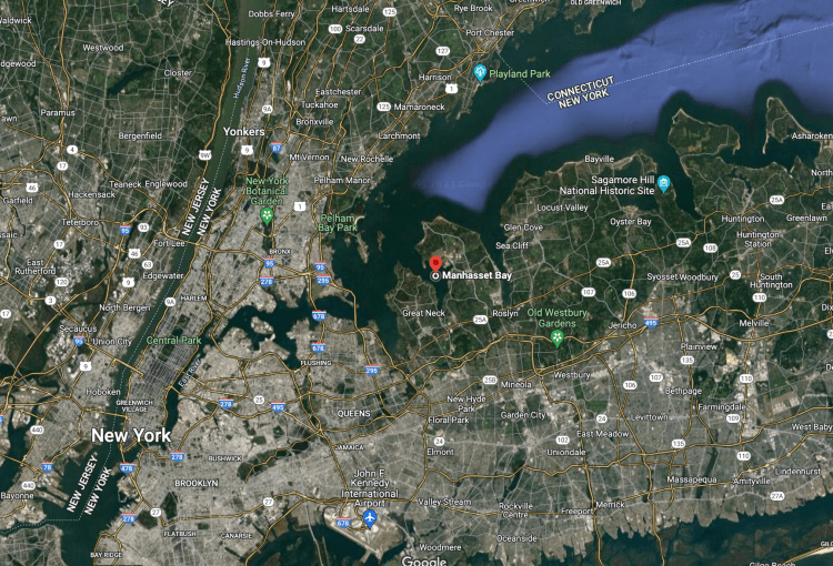
Port Washington is located in Manhasset Bay, a large bay with many marinas, moorings and still has lots of room for anchoring. Many boats on their way south seem to stop here to provision, make use of the easy public transit connections to downtown NYC, or like us wait out weather. This was the first point in the trip where we felt part of a real cruiser community. There were so many live-aboards stopping here on their way south, so many boats we had seen or met in anchorages along the way. Even some of the more known bloggers, got stuck here just like us. We were part of a larger migration. This was the first time we realized that this really was something a lot of people did – get on a boat and head south for the winter. We were part of a wave that would just become bigger and bigger the further south we travelled. Later, we found out that Chris Parker, the weather routing guru for sailors and cruisers, was telling everyone that Port Washington would be a perfect place to wait out Ophelia – no wonder!
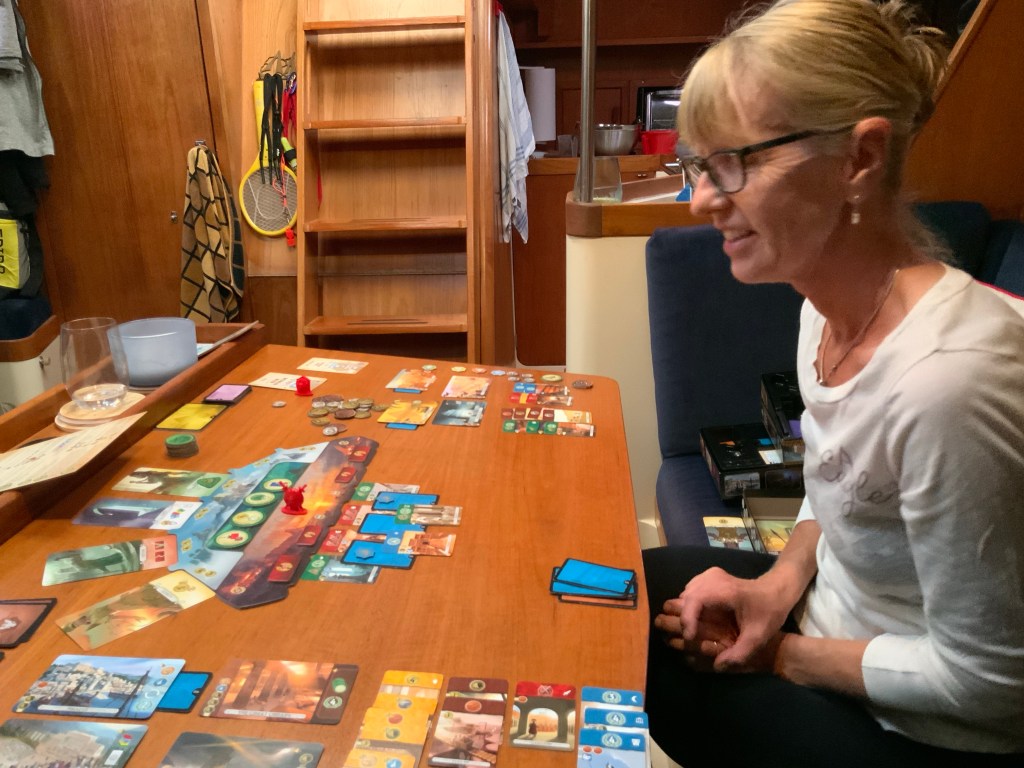
So what do we all actually do, when we are stuck on our little floating homes, when it is cold, damp, rainy and blowing out there. Well, we had our little propane heater going to keep warm, sat in the cabin of the boat, played board games, checked the weather, talked to friends and family on our devices, read, checked the weather, wrote updates to blogs, worked on boat projects, stuck our heads out into the cockpit once in a while to see if any boats had dragged or we had dragged, checked the weather again, checked the anchor alarm, and the wifis to see who was new in the anchorage and repeated it all the next day.
Sounds boring, but sometimes it’s actually nice to not be able to do much, although after a few days you do really feel like you need to get out of the boat and stretch your legs. In a way, I pitied the people who would dinghy by our boat in their foul weather gear splashing through the heavy waves, head down bracing against the wind and rain, while their four-legged friends where excitedly standing at the bow. When you have a dog, you still have to get out there to shore – but at least you get some fresh air and exercise.
We did have a couple of days before the storm really hit to enjoy some of the amenities the town has to offer. Port Washington really caters to boaters with a town dock with free pump out and water, another dinghy dock right by the Stop & Shop grocery, liquor store and laundromat. We managed to get in a few nice runs along the waterfront and were able to wheel the shopping cart with groceries and box of wine bottles right across the road to the dinghy dock. So much easier than multiple trips with heavy knapsacks!
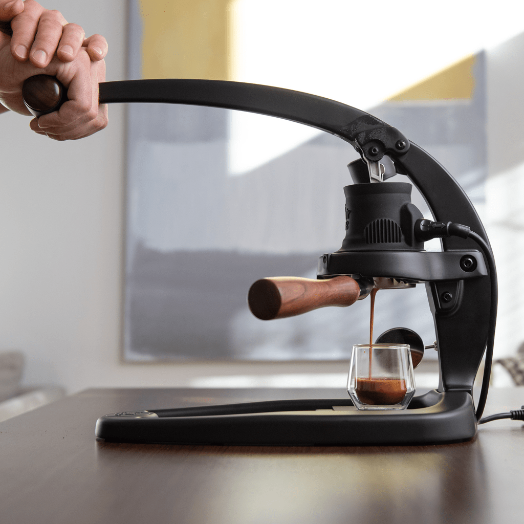
However, the best part about Port Washington was definitely the people we met. On our first day we met Kikki and Cedric from SV Seaside, a Canadian couple from Montreal as they were getting onto their fold up bikes at the dinghy dock. A half hour later we had exchanged contacts and were invited for drinks on their boat. This is were we met Allison and Chris from SV Purrfect, another Canadian couple from Alberta who have been living on their Lagoon 42 TPI catamaran for years. They all gave us tons of invaluable tips on their favourite anchorages in the ICW as well as the Bahamas. But that’s not all, Dave and Chris bonded over coffee. They are both what I would call “coffee snobs” – Dave introduced Chris to coffee roasting on the boat and Chris gave Dave a real cappuccino made on the boat – that would change our lives. It only took a few days for us to order the machine we had been introduced to and we have been enjoying the results ever since.
We also finally got to talk to Margie and Roger from SV Kiwi Dream – we had run into them coming into the Canso passage in Cape Breton and then again in Bras D’Or Lakes. Raftan’s crew Julie and Patrice, who we had briefly had drinks with back in Lunenburg, Nova Scotia were also there with us. On those late afternoons, when the weather allowed relatively dry dinghy rides between boats we hung out for happy hour, dinner or chats. This is were we found out after cruising around the coastal waters of the US for 2 months that we were supposed to report our arrival at every new port in the states, not just the initial port of entry intro the country. Like all the other cruisers we had downloaded the CBP Roam app that lets you report your entry by boat into the USA. We had initially had a little problem when we had entered into Maine from Grand Manan because we had used a port that wasn’t an official port of entry for the country. But a friendly CBP roam officer had called us back, we had cleared up the mistake verbally and then he had wished us a great trip. Well, apparently, there is more we are required to do. I noticed, Dave got very quiet as we were hearing from all our boating friend that most of them found it very difficult to do the reporting on the app as it was glitchy, that many had to resort to calling into a CBP office to report, that even the officers were unsure if every port or only major ports had to be reported. There was supposed to be a second button on the CBP roam app that lets you do the reporting easily, but we had only the one button to report when you enter the country. We were getting very nervous! The next day we would be going through NYC – what if border control actually stopped us and wanted to see where we had been and why we hadn’t reported. Hey – maybe we would be getting a free personal tour of Rikers?
That evening back on Vitae, Dave tried again and again, reloading the app – deleting all info, no luck. The next morning he called the closest NY Customs and Border office – they couldn’t help – yes, he had to report in, but it had to be through CBP Roam. What could we do? Luckily, Chris and Allison from Purrfect, came to the rescue. They had been having issues with their reporting as well, but had found a direct number with a national CBP supervisor who now knew them and always helped clear them in if things didn’t work. Allison forwarded the name and number of her special person to us. We were able to get checked in and put our paperwork in order. He explained that many Canadians had difficulty with the app and that the only thing they knew we could do was to call each time we move to a new port of call.
Update from Dave:
After fumbling with the app for some time, and hearing that it might have something to do with date format as the USA format was different than the Canadian one, I stumbled on the reason for the problems. There seem to be two dates in the apple phones: current location, and preferred location. The app for the US border protection must be using the preferred location field instead of the actual current location field. I went into global settings and changed from Canadian to USA – most Canadians would choose to have Canadian formatting preferences, and this is why they were having problems. After rebooting the phone, the second button magically appeared in the application for us, and we were able to quickly and easily report our cruising port of call. I emailed our special supervisor back with the info and he gave us his heartfelt thanks, promising to spread the word far and wide among the various border offices.
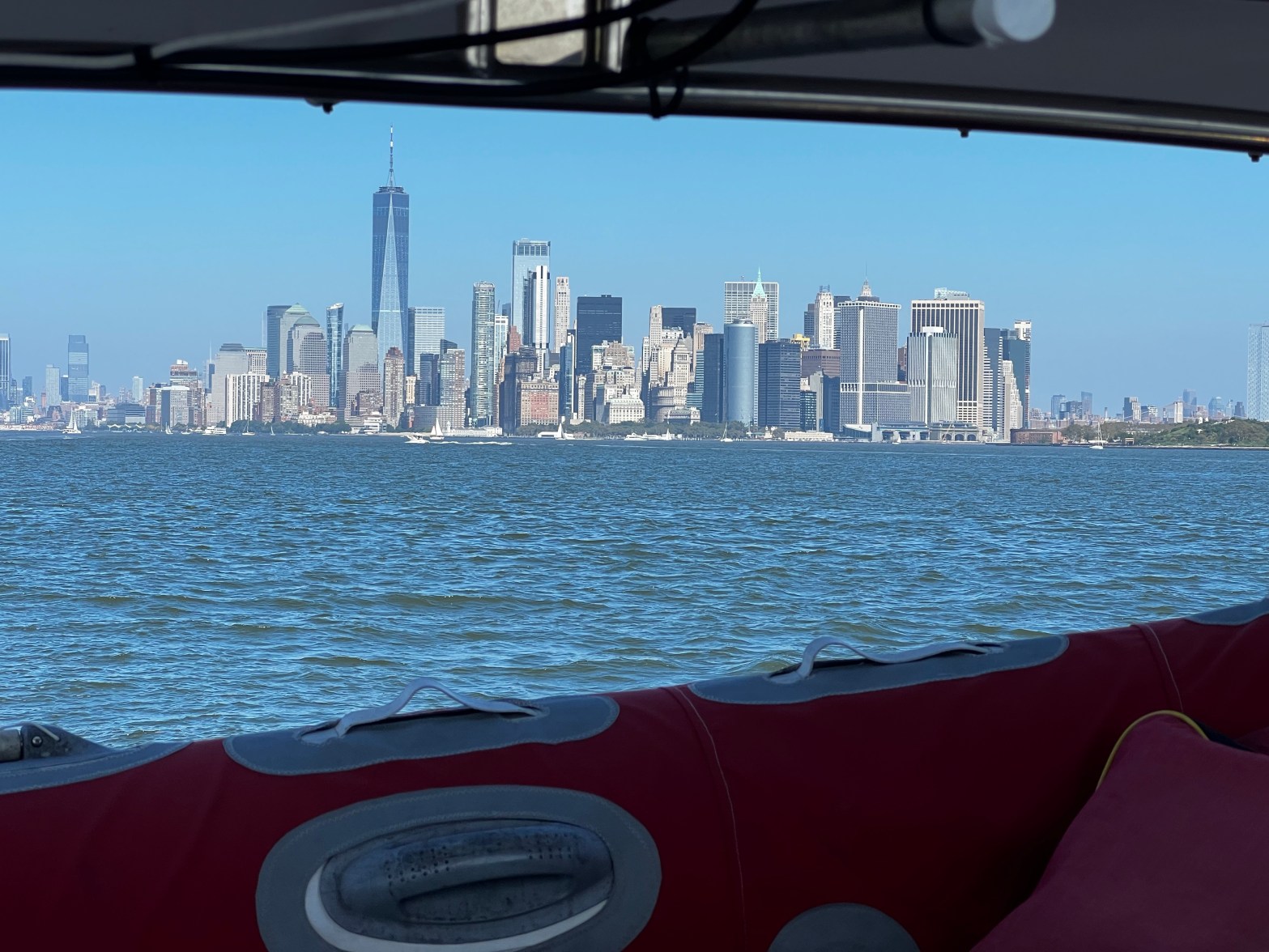
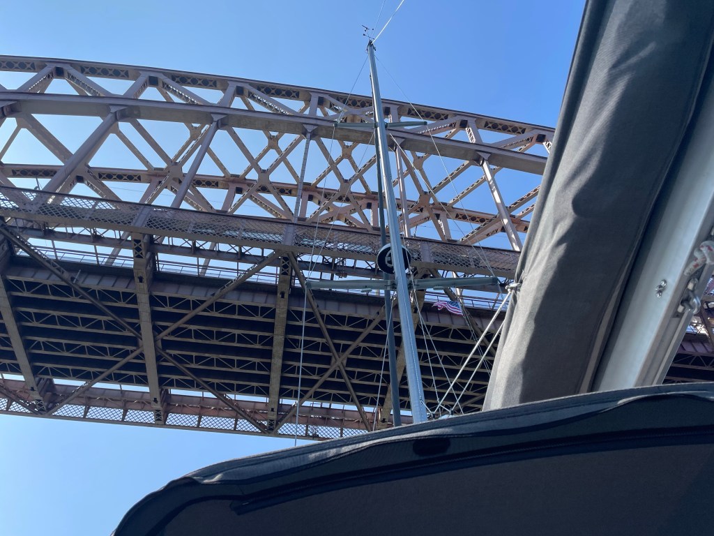
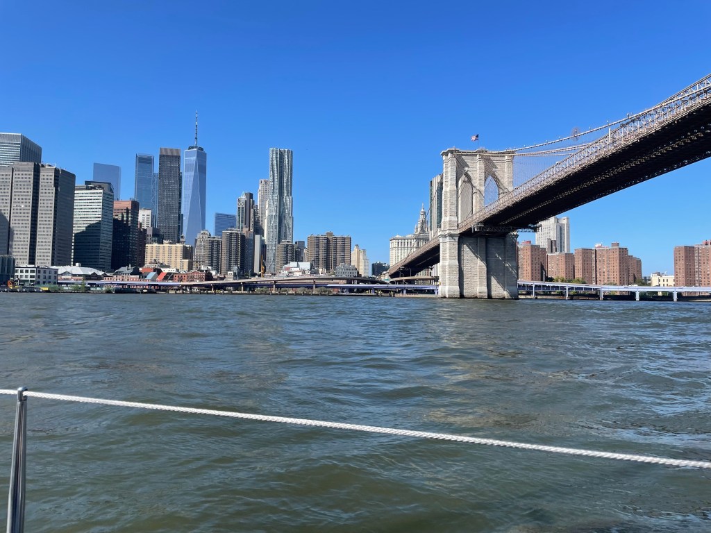
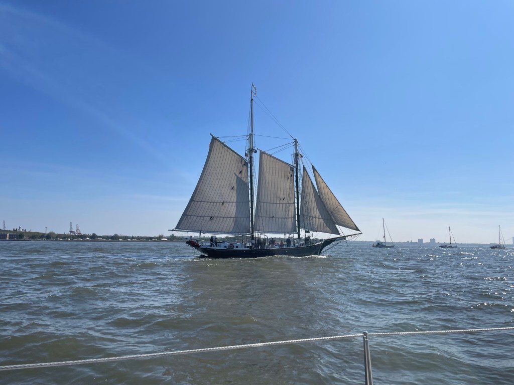
On October 1st it was finally sunny and beautiful again – the perfect day to go through New York City. Of course, everyone else was also finally getting out of Port Washington. That morning an armada of boats was making its way under the Throgs Neck Bridge, the first of 9 bridges that span over the East River and the Upper Bay. It was a beautiful sight. Some were even just under sail like Beau and Brandy on their sailboat Saoirse. It’s only got an electric motor, so they try and sail everywhere. We had met them at the Annapolis boat show the year before and that’s where they were heading again. Sailing through New York City – wow, I was glad we had a good engine to rely on with all the busy traffic through this huge metropolis. We had started relatively early in the morning and the east side was still somewhat quiet but the closer we got to Manhattan the busier it got. We were tossed around by wakes of large motor cruisers all the time. Heck, one large boat was going over 50kts/h through the relative narrow busy waterway. We passed the infamous Rikers Island with its famous prison, went through Hell Gate – known for its strong currents. If you enter this area of the river at the wrong time you might be fighting a current of up to 5kts against you, which would mean we would not be going anywhere. Having sailed down the St. Lawrence River, we had gained experience with tides and river currents so we picked our passage time accordingly.
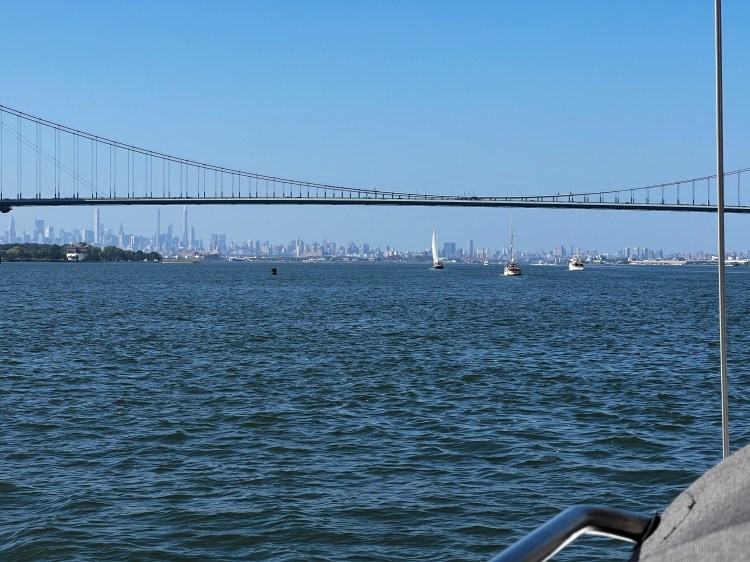
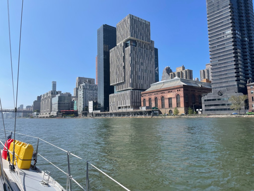
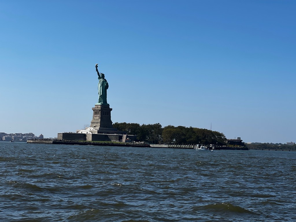
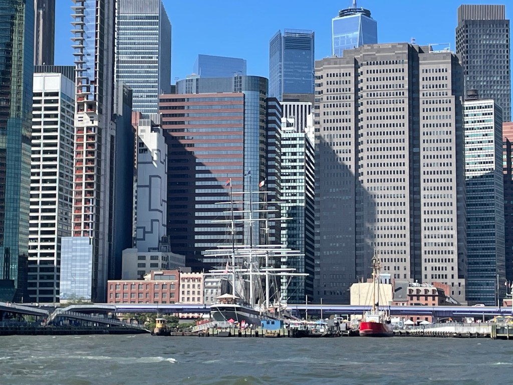
It was a great experience seeing New York City from the water. It was breathtaking to see all those immense buildings, float under the stunning bridges and look up the street blocks with their gigantic walls of skyscapers and high-rises. I took way too many pictures, like everybody does, but they don’t really express how grandiose this city is. At the west end, the East River widens into the Upper Bay and the boat traffic now also goes criss cross with ferries, pleasure boats, tour boats, tall ships and its mayhem – while you are trying to snap shots at it all, get a good pic of the Statue of Liberty and “uh” and “ah” over everything. Luckily, Dave kept his cool at the wheel.

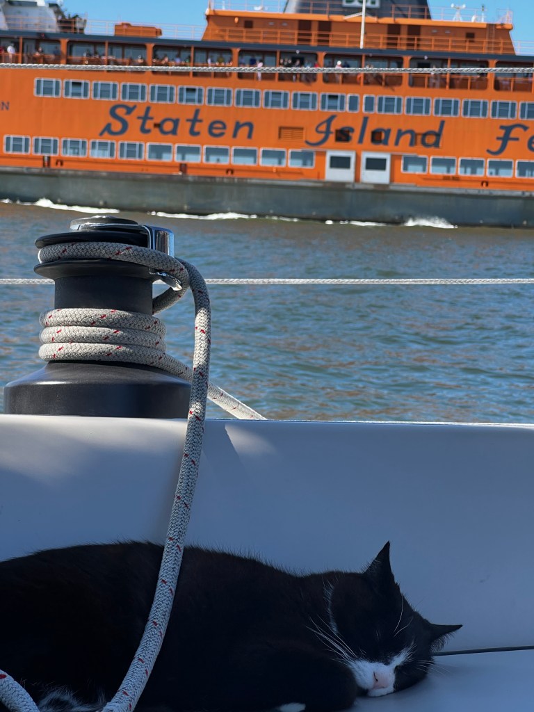
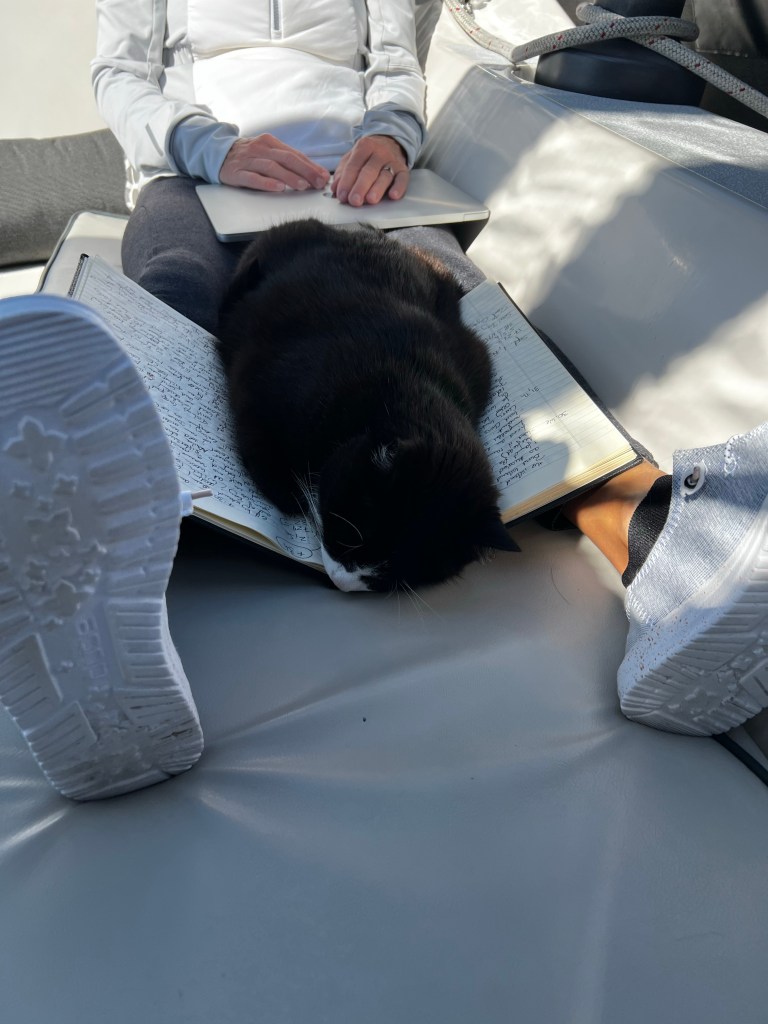
While the AIS signals on our chart plotter looked more like a crazy mess of intersecting lines, Momo, our cat was not impressed! He slept through most of crazy boat traffic.
We were so distracted by all that was going on, we didn’t even notice our friends Shane and Lori on Foghorn Lullaby showing up on AIS. These are the guys that started us on our sailing path about 8 years ago. We totally blame them! They talked us into taking a fall keelboat sailing course in Cobourg, in a cold and blustery Lake Ontario. But all four of us were hooked once we got out on the water and under sail. Both couples bought their first sailboat the next spring and then moved onto a bigger sailboat from there. Many nights were spent at anchor hatching out future plans for sailing down south. It took a few years honing our skills and getting our ‘older’ boats ready, but we did it. While we wanted to take the long way out the St. Lawrence, they had chosen the canal route starting in Oswego with the unstepped mast strapped to the deck, then the Erie Canal and ending up in the Hudson River. Of course, the plan was to meet up somewhere along the trip, but none of us ever imagined that it would happen as soon as our routes would cross. The stars (or storms) had aligned – we had been delayed by weather and they literally anchored in Sandy Hook, New Jersey, not even an hour before we got there. Sandy Hook, is the northern sand barrier strip of the New Jersey coast. It forms a protective hook to the south of NYC and the Lower New York Bay. It got glassy calm once we had anchored and Foggy’s crew came over for a very happy “Happy Hour”. Many of our new found friends had also made it here. Purrfect anchored right in front of us and Raftan was also there. Unfortunately, there wasn’t a lot of time for more Happy Hours as we all wanted to finally get further south, so an early start the next morning was crucial.
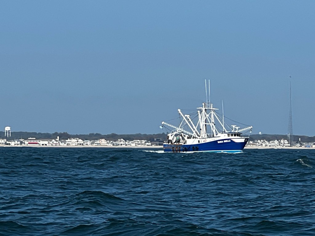
Early at 4:30 am we got up and after a quick coffee and breakfast were got on our way around the point of Sandy Hook. There was a slight north wind but with the swell rolling us there wasn’t enough to keep the Main from slapping even with a jibe protect. So we motorsailed with the jib for stability. In the afternoon we were getting a bit of favourable south current helping us along to make 6-7kts/h. It still took 13 hours by the time we were entering the inlet at Atlantic City, NJ.
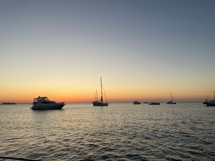
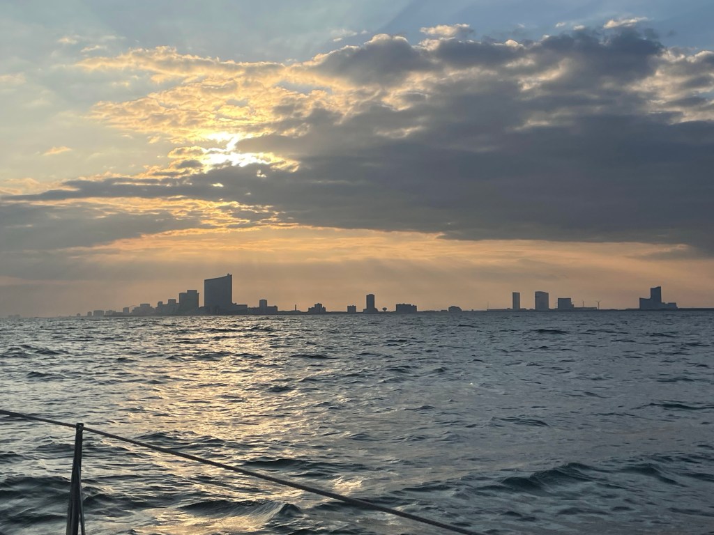
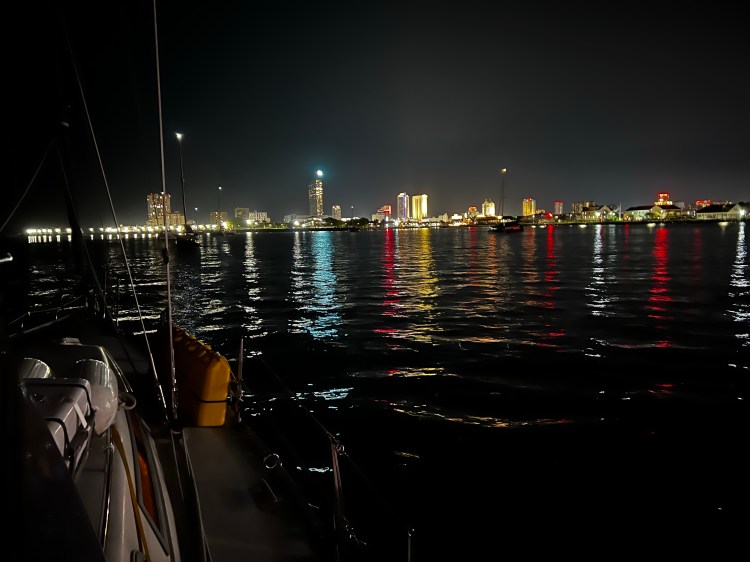
I never realized how much beach there is along this coast line with shoaling sandy areas along the shore, so entering with a sailboat even in moderate swell is a bit scary if you don’t have local knowledge. So we opted for Atlantic City – a well marked deep entrance with long breakwaters protecting the entrance. Atlantic city sticks out from the surrounding low lying small beach towns. Impressive high hotels, casinos and an amusement park can be seen quite far out in the ocean. At night the lights are beautiful. We just pulled in as the sun was setting and anchored right in front of the bridge with a small handful of catamarans and monohulls. It was surprisingly not rolley at all and we had a good night in front of Harrah’s Resort.
After a restful night we were on our way again by 8 am the next morning. We were now heading into a light wind, but by noon it switched to the SW and we were able to raise the main to help us along while we motored. The Jersey coast is so amazingly flat, but every beach town seems to sport an amusement park with roller coaster, at least that’s what we noticed from the water. Pelicans were now more and more common on the ocean, ever since we had come past NYC.
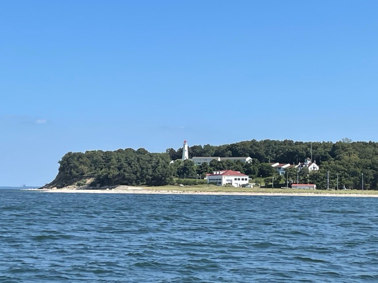
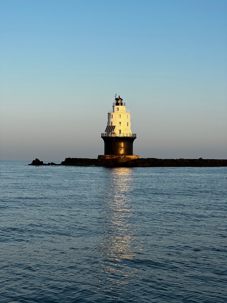
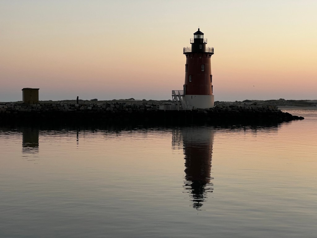
As we were approaching the southern tip of the New Jersey coast, just before the Delaware River inlet, the wind finally filled in and we turned off the Iron Jenny. It was bliss gliding along in the sunny late afternoon, with the occasional dolphin to swim along the boat. Sorry, no pictures, it seems they still are smarter than me – they dive off as soon as I get the iPhone out. We crossed over the inlet of the Delaware and pulled in at a very unique anchorage on the south east corner of the river. It’s called Breakwater Harbor or Harbor of Refuge. Construction of this harbor with break walls was started in 1828, with an inner break wall which has the East End Light house as a marker. This lighthouse is no longer active. The harbor was intended as a refuge for boats from the Atlantic and could hold as many as 200 boats in a storm. Unfortunately, as ships were increasing in size the harbor became too small. Eventually, in 1896 another break wall was added with larger stones and a new light. The new breakwater was 8,040 feet (2,450 m) long at low water and 40 feet (12 m) wide. Ten icebreaker piers were built 1,250 feet (380 m) to the north of dressed stone in a 1,300 feet (400 m) line. Getting into this harbor through the opening which is a deep marked channel, looked more ominous than it actually was. The water was churning with current, but depth was good and charts accurate. Once inside it was very protected and quiet. We swung 180 degrees over night in the current , but holding was excellent. It also looked like one would have access to the shore and it would have been cool to explore the beach and shore. For us it was just a great spot to drop the hook before timing the current and going up the Delaware River to the C and D canal (the canal connecting the Chesapeake with the Delaware River) the next day.
| Date | Description | Distance | Travel time |
| Sept. 20/23 | New Haven, CT to Northport Harbor anchorage, NY | 37.91NM | 7:16h |
| Sept. 21/23 | Northport Harbor, NY to Port Washington, NY | 22.46NM | 4:47h |
| Sept. 22 to Sept. 30/23 | Port Washington, NY (waiting out bad weather due to tropical storm Ophelia) | | |
| Oct. 1/23 | Port Washington, NY to Sandy Hook Point anchorage, New Jersey | 33.54NM | 5:46h |
| Oct. 2/23 | Sandy Hook Point to Atlantic City (anchorage south of bridge) | 78.6NM | 13:12h |
| Oct. 3/23 | Atlantic City to Lewes, Breakwater Harbor anchorage, DE | 49.98NM | 10:10h |
| 14 days | Total | 222.49NM | 41:11h |
| 119 days | Total trip so far | 2,239.51NM | 392:14h |

Glad that stretch worked out well for you both. Enjoy your time in the south. Hope you get faivoirabke winds to the Bahamas soon. Keep the blogs coming. Merry Christmas from SV Komeekha in Carriacou, Grenada
Cheers
Frank and Marie-Claude
LikeLiked by 1 person
Thanks Frank, it’s been a bit of a wait but the window has to come soon!
LikeLiked by 1 person