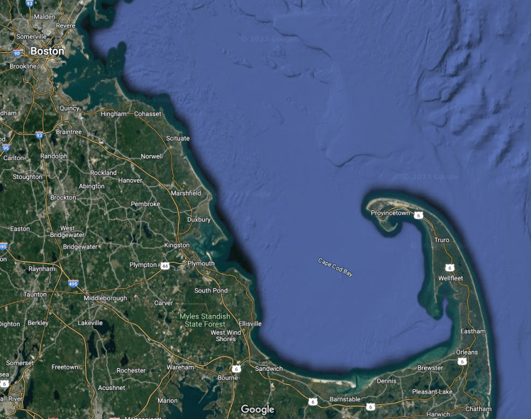
After Maine our next big stop would be Connecticut to visit with some friends from university days, other than that we had not made any definite plans, just sail further south, of course. Well, the next shore to follow was Massachusetts, but where did we want to stop? Our buddy boat Breakaway had taken a different course a few days before meeting up with family in Maine. Their home port was Marblehead, or rather Salem, MA and now they were also on their way there, just a day behind us. In fact, they offered up their friends mooring ball to us – which was a real treat.

So on a gorgeous Tuesday morning in early September we left the Isles of Shoales behind us, determined to sail all day. The seas were calm and the sun was beating down. Eventually we did have to give up and turn on the engine as we were barely making a knot of speed. We passed the 18miles of New Hampshire coast line far offshore as we were heading straight down to Cape Ann, going just east of the Dry Salvages, a group of rocks causing impressive breakers to throw spray high into the air. Once around Cape Ann lighthouse we turned a bit more westerly and could sail surfing on the waves. We went by the famous towns of Gloucester and Manchester-By-The-Sea and sailed the Salem Channel right into the Salem Sound.
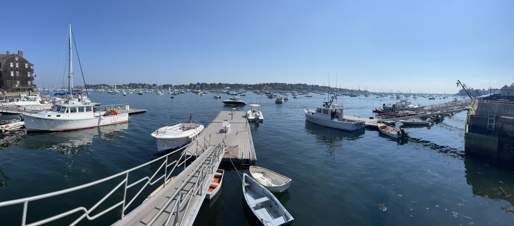
OMG, I have never seen so many boats in a bay! Not only are there a number of marinas and yacht clubs but the sheer amount of mooring balls with boats of all sizes but mostly sailboat was almost overwhelming. “Between Salem and the adjacent waters of Beverly, Marblehead and Danvers, there are an estimated 8000 moored or slipped recreational boats using the waters of Salem Sound”, according to the City of Salem, Harbourmaster. How would we ever find this mooring ball? Luckily, Len and Chris had sent us very detailed directions and the mooring field was divided into sections by letters. The mooring even had a pick-up stick so I didn’t even need my boathook to grab the lines.
Salem is of course infamous for the 1692 witch trials, a part of past that makes me shiver each time I think of the irrational injustices committed by those in power. But the town also boasts many historic homes as the first Europeans settled in 1626. It became one of the most important seaports for trading commodities during the early colonial history of the US. The “Friendship of Salem”, a replica of the original 2-decked, three-masted, square-rigged, 342 ton vessel by the name “Friendship” (definitely not a friendship sloop!), built in 1796-7, is moored at the Derby Wharf. This merchant ship was a so called “East Indiaman”, bringing coffee, salt, spices, silk and more from the East Indies, as well as Asia.
Today Salem is a touristy little town on the north west side of the sound with Marblehead on the southeasterly side. There are a few smaller stops for some groceries but we decided – getting our legs used to land again – to hike down to Wholefoods in Swampscott. There is a floating public dock on the Marblehead side of the bay, the Village street dock. No one seemed to give us a hard time leaving our dinghy there for longer than the time limit on the sign. A brisk walk of an hour (3.1miles, about 5km), a large shopping with a stop for lots of wine at the store beside and an Uber ride later, we were back at the boat. By then Len and Chris had arrived back and so had their friends on V-Tac. Oops, we were on their mooring ball – no problem. As the boating season was winding down there was an open mooring right beside them and we quickly switched over before going out for dinner in Marblehead with them. We sat on the patio at Sea Salt until the mosquitos chased us out. How nice to have such great chauffeurs! Thank you Len and Chris for driving us to the laundromat and taking Dave to fill our propane tank for the boat.
After a very productive 2 days in Salem we headed over to the Misery Islands, still in the sound but just 5NM east. The islands are named after a shipbuilder became stranded there during a winter storm in 1620, and he spent “3 miserable days” there. Now the islands are public. On the way we scooted over to Marblehead Bay and filled up with water and fuel at Tuckers Wharf. Misery Island has some free mooring balls of which we grabbed one right behind our friends from Breakaway. Len helped from his dinghy getting our mooring lines through the ball as they have no lines on them. Most boat traffic stopped after sunset and just a little wave action continued through the anchorage overnight. Nothing that could keep us from sleeping.
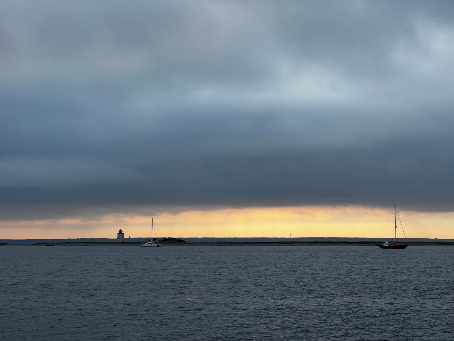
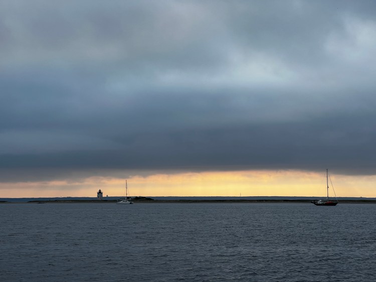
By 7am we were following Breakaway for an upwind sail to Cape Cod, more specifically Provincetown or P-Town as they call it here. Waves were relatively small and we enjoyed 10 hours of sailing. Although the last 2 1/2 miles around the northern tip of Cape Cod, we did turn the engine on. The point seemed to be getting longer and longer as we had to come almost 270 degrees around.
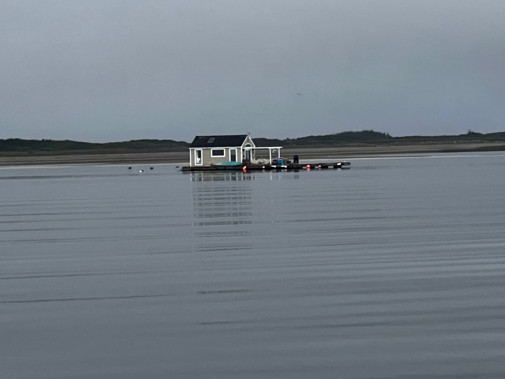
We tucked right into the bay behind it and set our anchor in 50′ of depth (tides are up to 12′ here) with a sandy bottom. The bay is deep all the way around and then shallows quickly around the shore. We have only 200′ of chain with our 25kg Rocna and all of it went down. We were a little uneasy about our scope not being high enough. You do the math: 200/60 that’s 3 to 1 at high tide. We had some extra rode that we would be able to add if the wind got worse. However, the holding was excellent and we did not budge for 3 days.

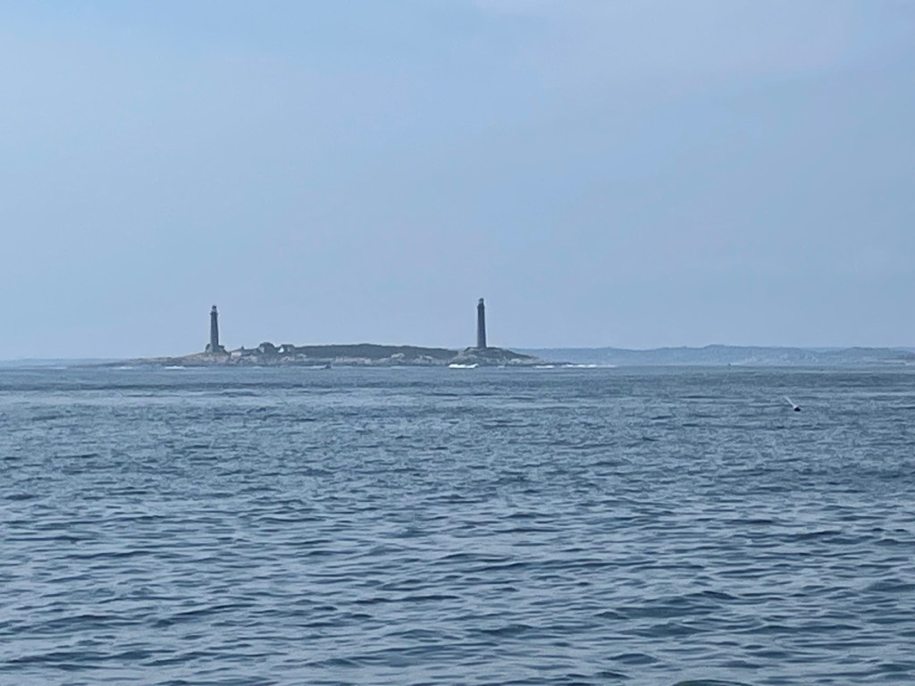
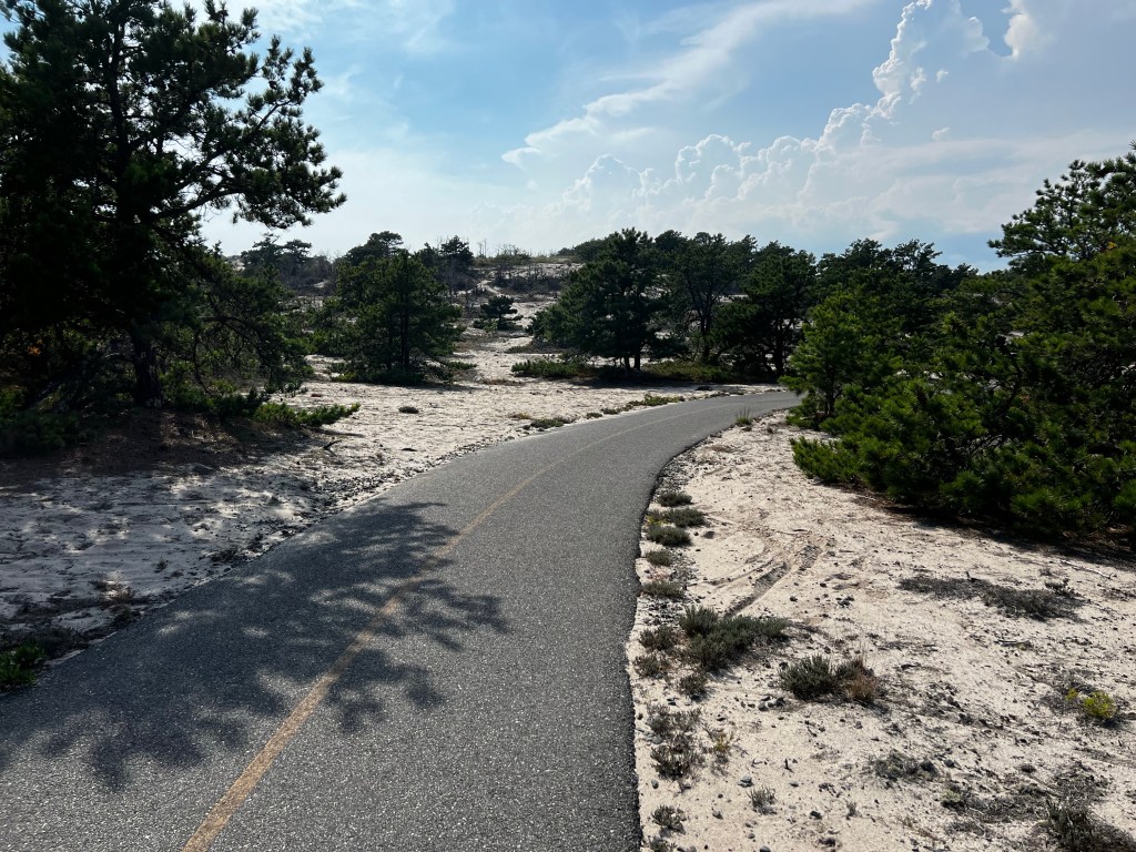
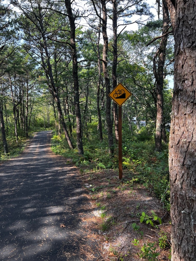
Provincetown is truly a unique place in many ways. Not only is it geographically very different being situated about 60 miles out in the Atlantic, surrounded by huge beaches and dunes. Since the first European settlers on the famous “Mayflower” anchored in its sheltered bay it has developed into a town that attracts artists, summer tourists and members of the LGBTQ+ community alike. The town has a fun and almost carnivalesque flair with lots of interesting shops, restaurants and galleries. Riding through on our bikes gave us but a glimpse of all this. We did get out and rode the beautiful paved bike lanes through the dunes on a hot afternoon.
Our anchorage was about a mile by dinghy to the large town dock, but it made for a much quieter evening at the boat – as P-Town rarely sleeps. Chris and Len had us over to their boat for swordfish which was delicious and we reciprocated with some barbecued chicken, rice and broccoli on Vitae the next night. The bay was also a nursing ground for seals and we could hear their howls and watch them circle their young from a distance. Chris warned me not to jump off the boat for a swim as the sharks sometimes prowl for the young seals. Yikes!
P-Town was our last stop in Massachussetts and this meant saying Good Bye once more to our new friends Len and Chris on Breakaway. We also knew that another hurricane, this time it was Lee, was making its way up towards the Eastern shoreline of the US. It was predicted to come near Cape Cod and then hit Maine and Nova Scotia’s Southwestern Shore. We needed to get South.
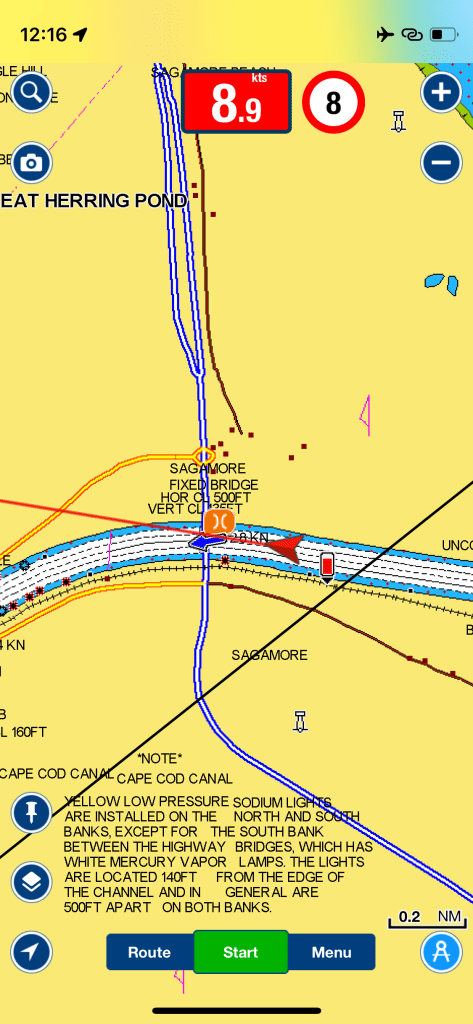
So on Monday, September 11, we hoisted anchor and left Cape Cod behind us. It was a foggy and calm day and by noon we got to the Cape Cod Canal, which is an artificial waterway (part of the Atlantic Intracoastal Waterway) that connects Cape Cod Bay on the north side to Buzzards Bay on the south. For boaters it means a safe inland waterway of 28km as an alternative to having to travel the 217km around the Atlantic side of Cape Cod. There are no locks in this canal, but it has to be timed with the tides flowing through, which can flow more than 5kts in either direction. We still hit it at a good time and got a push of 2.5kts extra. It was rather funny to see that we were even breaking the speed limit on the canal in our sailboat while motoring. Even Navionics was posting the 8kts limit on the chart plotter while we were traversing the canal. Here it shows our speed as 8.9kts. Probably the only time we have ever broken a speed limit with our sailboat!
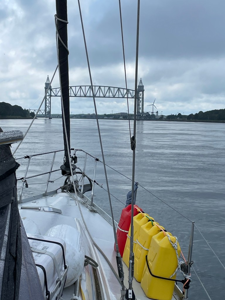

There are 3 bridges in the canal of which the most westerly is a lifting rail bridge which has to be called on VHF 14.
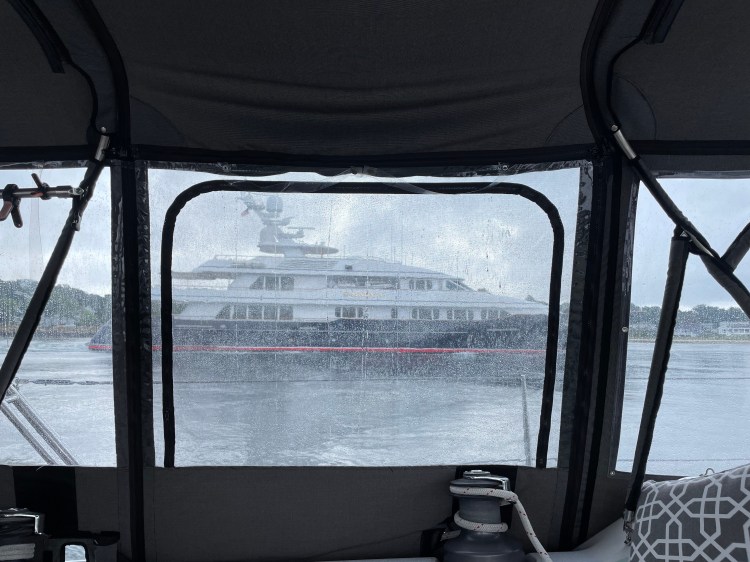
Meanwhile on the lower end of the canal a large hundred foot motor yacht hailed us to make us move out of his way so he could pass us, going even faster! I was glad he got called out by the US Coast Guard station which is located right at this end of the canal. He did cause a huge wake for everyone.
We had picked a calm day for going through the canal and were greeted with 10kts of wind from the SE as we entered Buzzards Bay on the West side of the canal. This bay can get choppy with opposing tide and stronger winds, but we were able to put both sails up and have a pleasant sail. By 4:30pm the winds started to die down and we decided to turn a bit south into Cuttyhunk Island to anchor. This is part of the Elizabeth Islands and is still part of the state of Massachussetts. It has a rather protected little harbour but it’s entrance is quiet shallow and narrow. As it was a calm night we anchored with a few other sailboats in the outer anchorage and were lulled to sleep by the ocean surf crashing into the reef on the Atlantic side of the Island. There is actually a small channel through here, but we did not feel any ocean swell.
We were glad to be past Cape Cod and now entering the area of the Long Island Sound and Connecticut. Hurricane Lee was making it’s way closer and we would be able to find better protection here.
| Date | Description | Distance | Travel time |
| Sept. 5/23 | Isles of Shoales, New Hampshire to Salem, MA (friend’s mooring) | 39.57NM | 8:26h |
| Sept. 6/23 | Salem mooring field | ||
| Sept. 7/23 | Salem mooring to Misery Island anchorage (with a stop at Marble Head, Tuckers Wharf (water and fuel) | 6.3NM | 2h |
| Sept. 8/23 | Misery Island to Providence Town anchorage (Cape Cod) | 52.33NM | 10:29h |
| Sept 9 to 10/23 | P-Town anchorage (Cape Cod) | ||
| Sept. 11/23 | P-Town to Cuttyhunk Island anchorage (going through Cape Cod Canal) | 53.44NM | 10:10h |
| 7 days | Total | 151.64NM | 31:05h |
| 97days | Total trip so far | 1913.44NM | 328:17h |

Greetings from Desert Hot Springs! The two Gaviidaes are here and we are plotting our next season, literally! I’m taking where you stopped each day and adding a marker in Navionics – then I’m sharing with Howard. Hope you get to cross the gulfstream soon!
Julie, Daniel, Howard, and Kerri-Ann
LikeLike
Glad it’s helpful. Bahamas are so close yet so far right now. Weather is awful and we have been stuck at anchor for a couple days now. We have a great group of boats all waiting it out with us and that makes it easier. Say hi to everyone there.
LikeLike