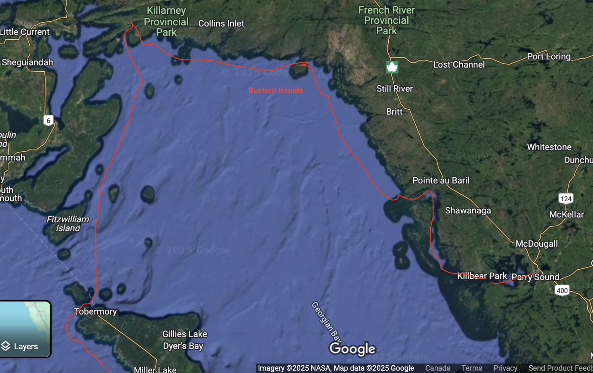
After making the decision to move Vitae north for a few years to explore Georgian Bay, revisit the North Channel and beyond, we set off for Midland on June 5th. Since we've already documented the travel up to the North Channel in 2021, I won't retrace every step — instead, here are the highlights of the journey and the first weeks settling into Georgian Bay.
The Bustard Islands
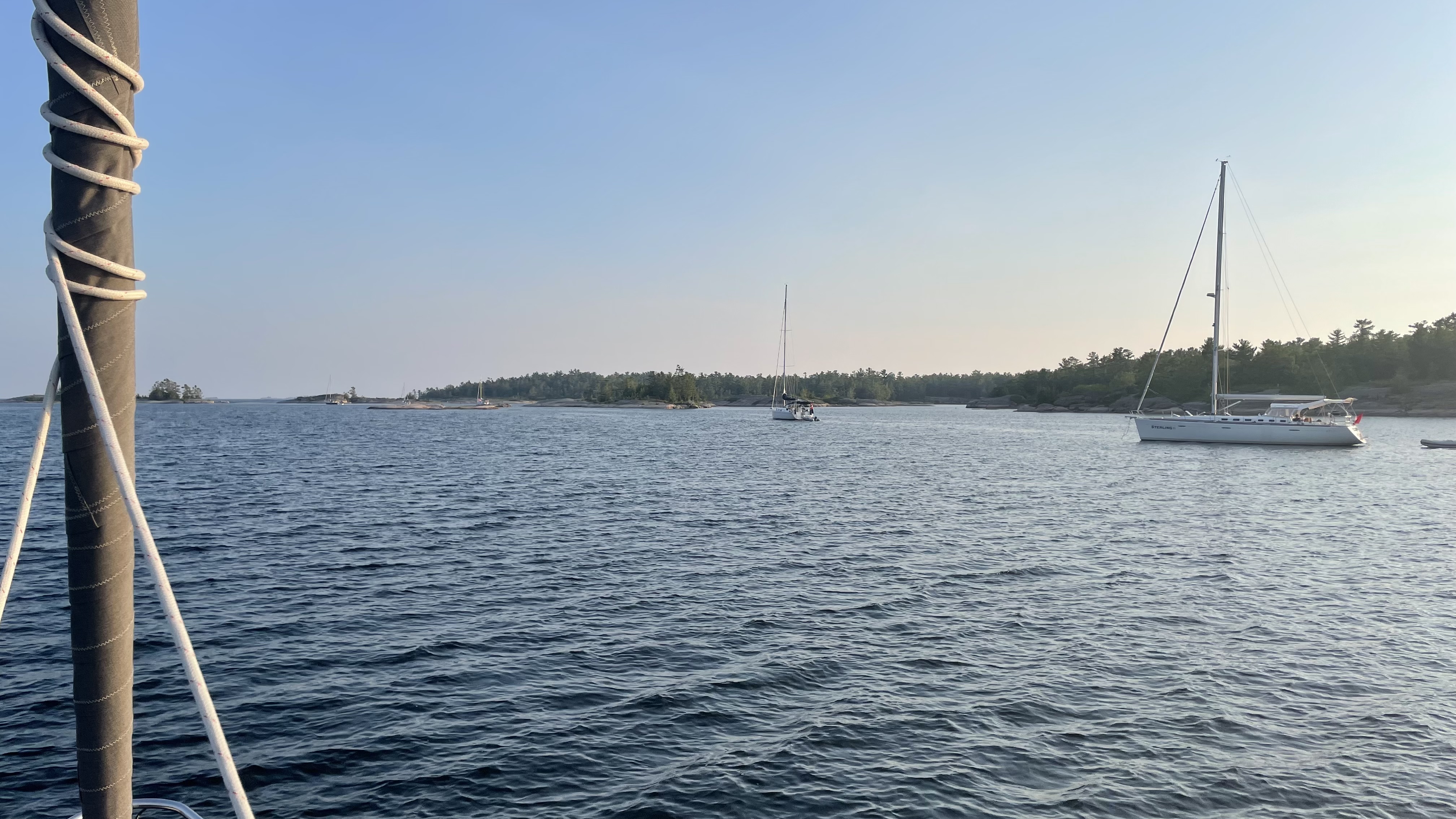
The Bustards were a definite highlight. Their relative remoteness at the north-east corner of Georgian Bay, near the French River outlet, makes this cluster of rocky, windswept islands a haven for anyone seeking quiet anchorages away from the crowds.
We had heard that on hot summer weekends there could be 15 boats packed into both the western and eastern anchorages, but arriving on a Monday in early July from Covered Portage in Killarney, we found only three or four boats in each. The contrast with Killarney — already getting busy — was immediately welcome.
Winds were from the SW when we arrived, so we chose the eastern anchorage, which offers a straightforward approach: a clear channel in with a little bay tucked behind the two islands on the south shore. Water levels in 2025 were noticeably lower than in past years but still above datum by at least a foot. We anchored in 15 feet, then ran two stern lines ashore to keep ourselves centred in the bay and out of anyone's way.
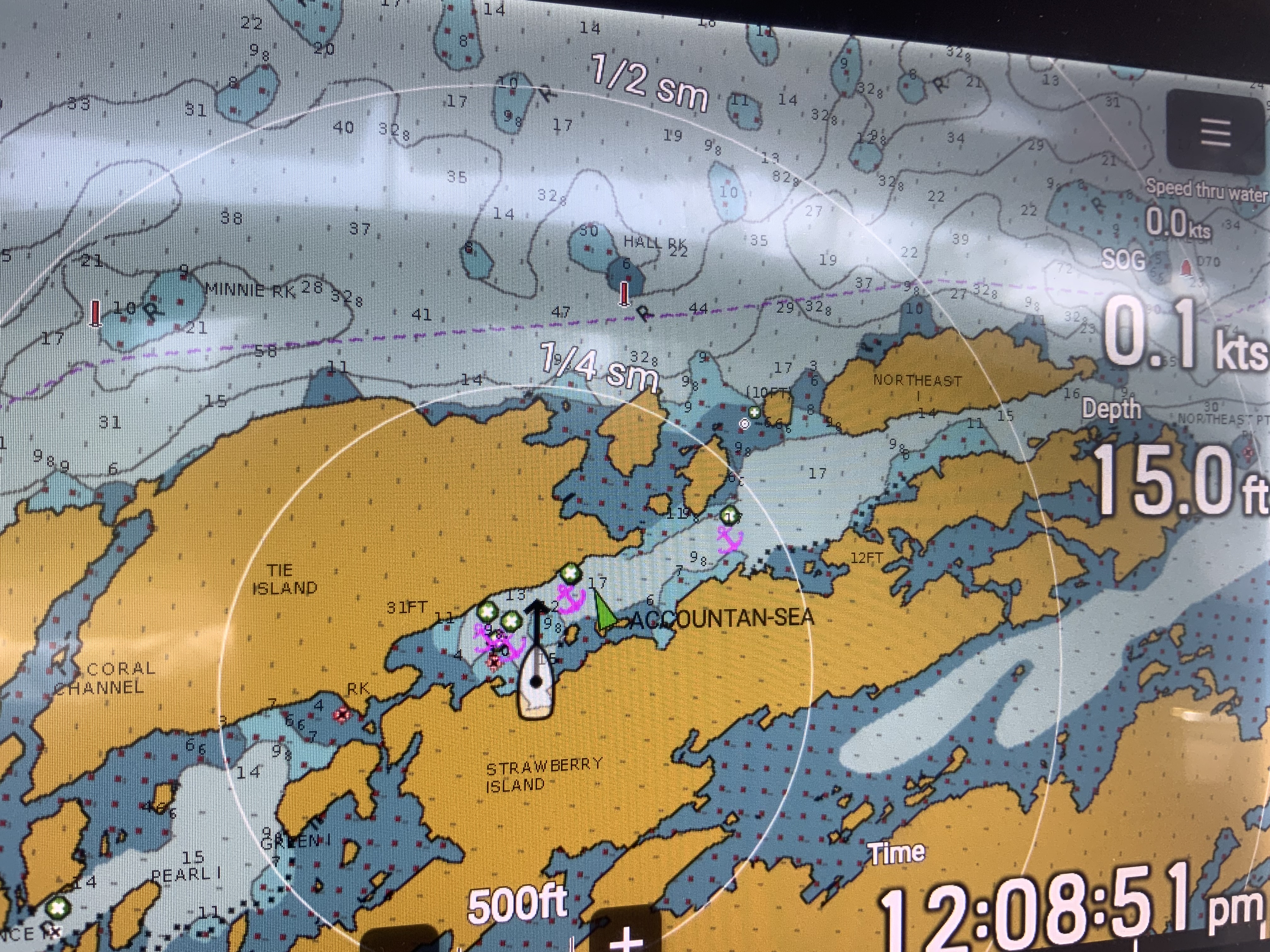

The first night was no problem with the SW wind pushing us gently toward our shore tie. The second night was a different story: winds switched 180° to NE with gusts up to 26 knots. We were bow-into the wind with a good anchor set, and thankfully a strip of land and trees behind us offered some protection. The question in any rocky anchorage is always how much mud or clay lies over the rock — we were lucky and the anchor never shifted. Because we didn't swing at all, it never had to reset either. It was, however, a thoroughly wet and rainy day and night, which made the decision to stay a third night easy. We were comfortably spider-webbed in place and the location was gorgeous.
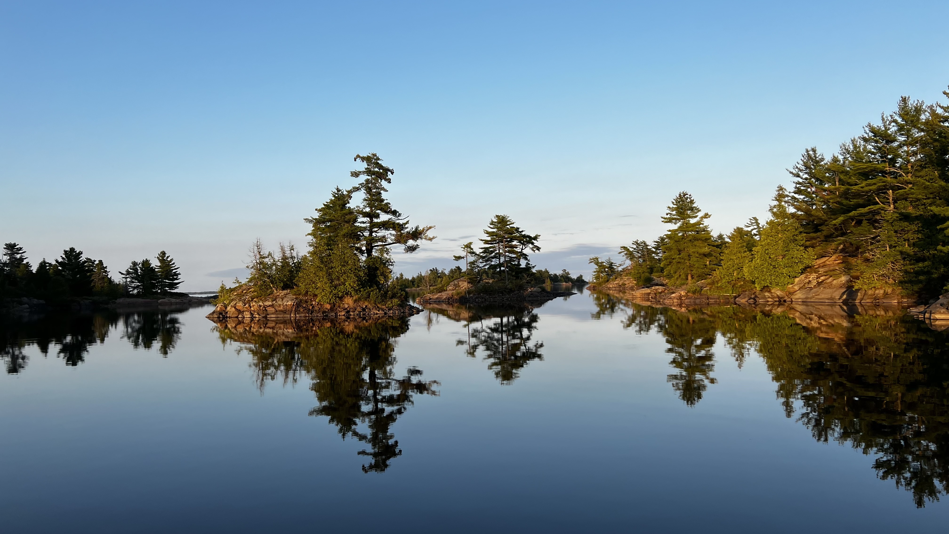
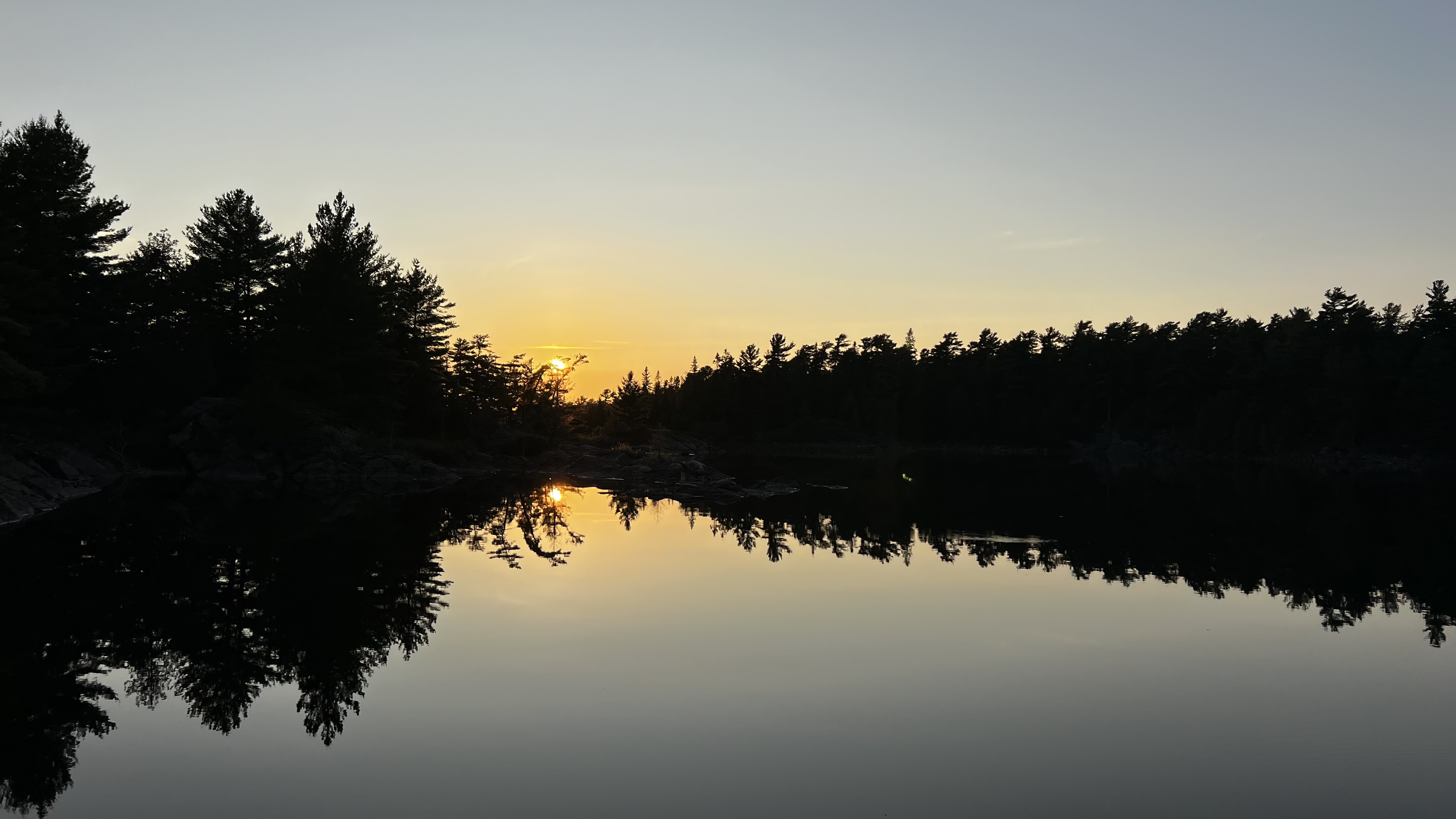
The Bustards have been compared to the Benjamins in the North Channel, and there are similarities — windswept rocky channels, wild and exposed — but the Bustards feel more established, with majestic white pines and cedars and dense underbrush that make the anchorage feel sheltered and peaceful.
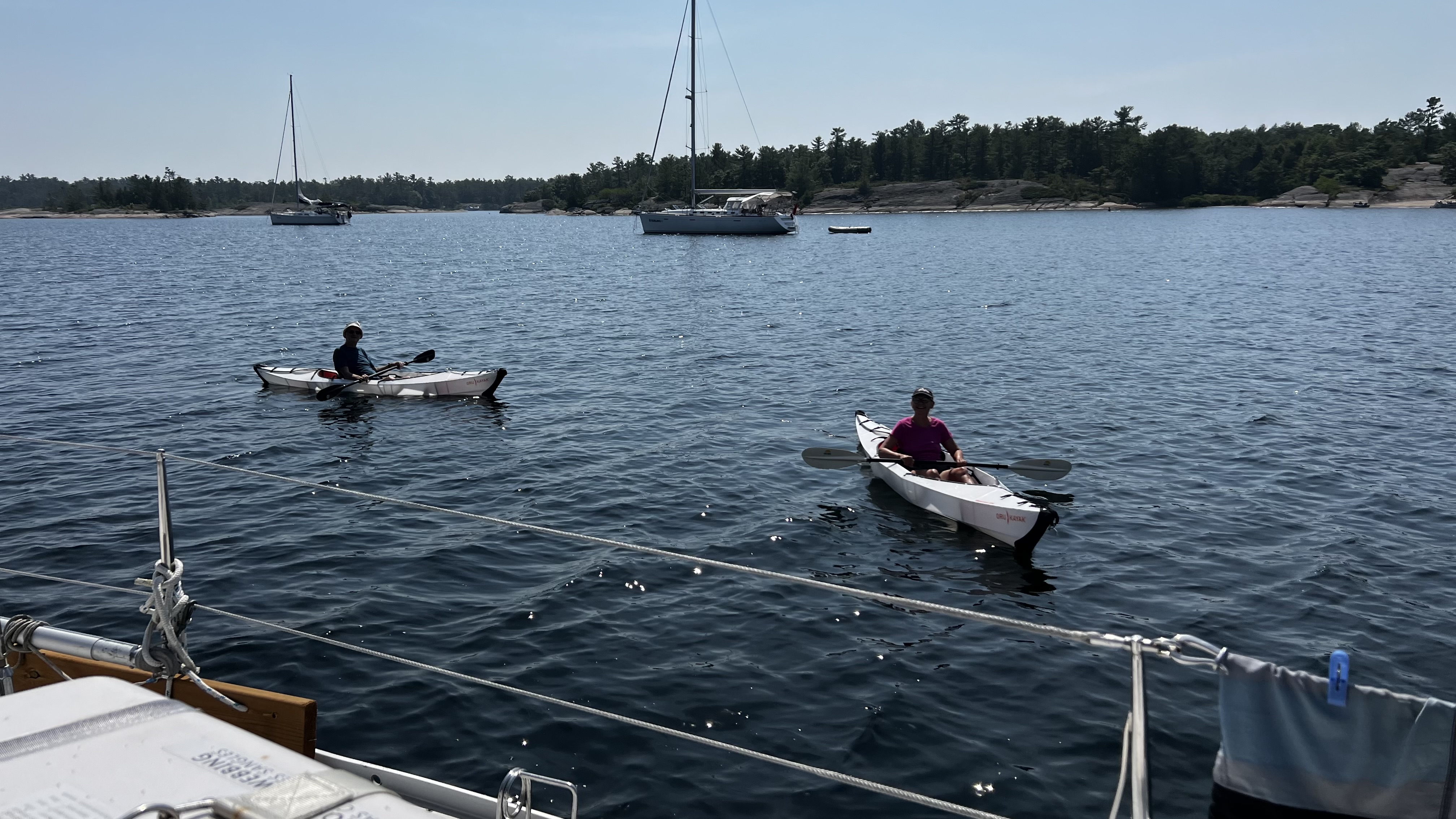
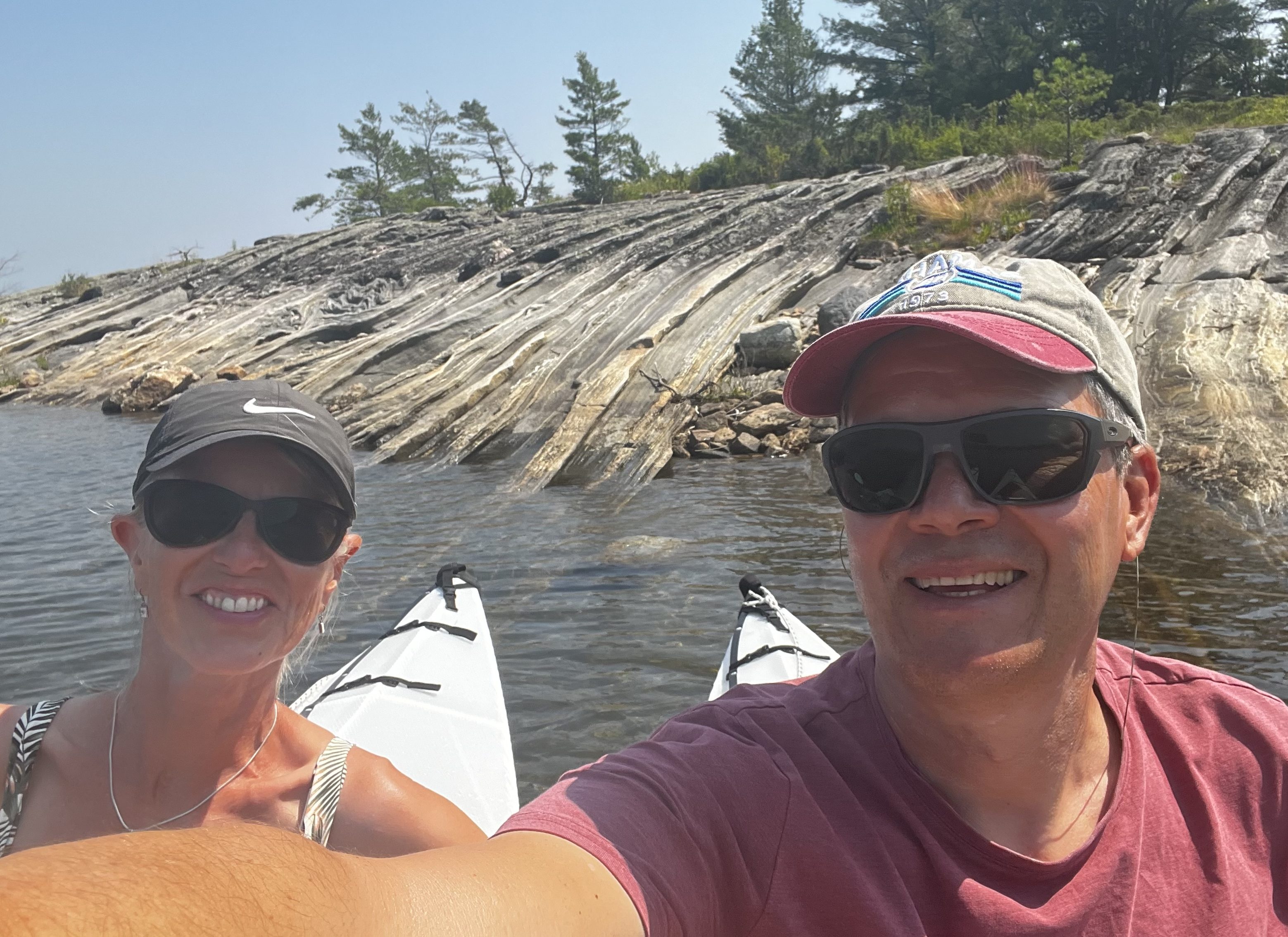
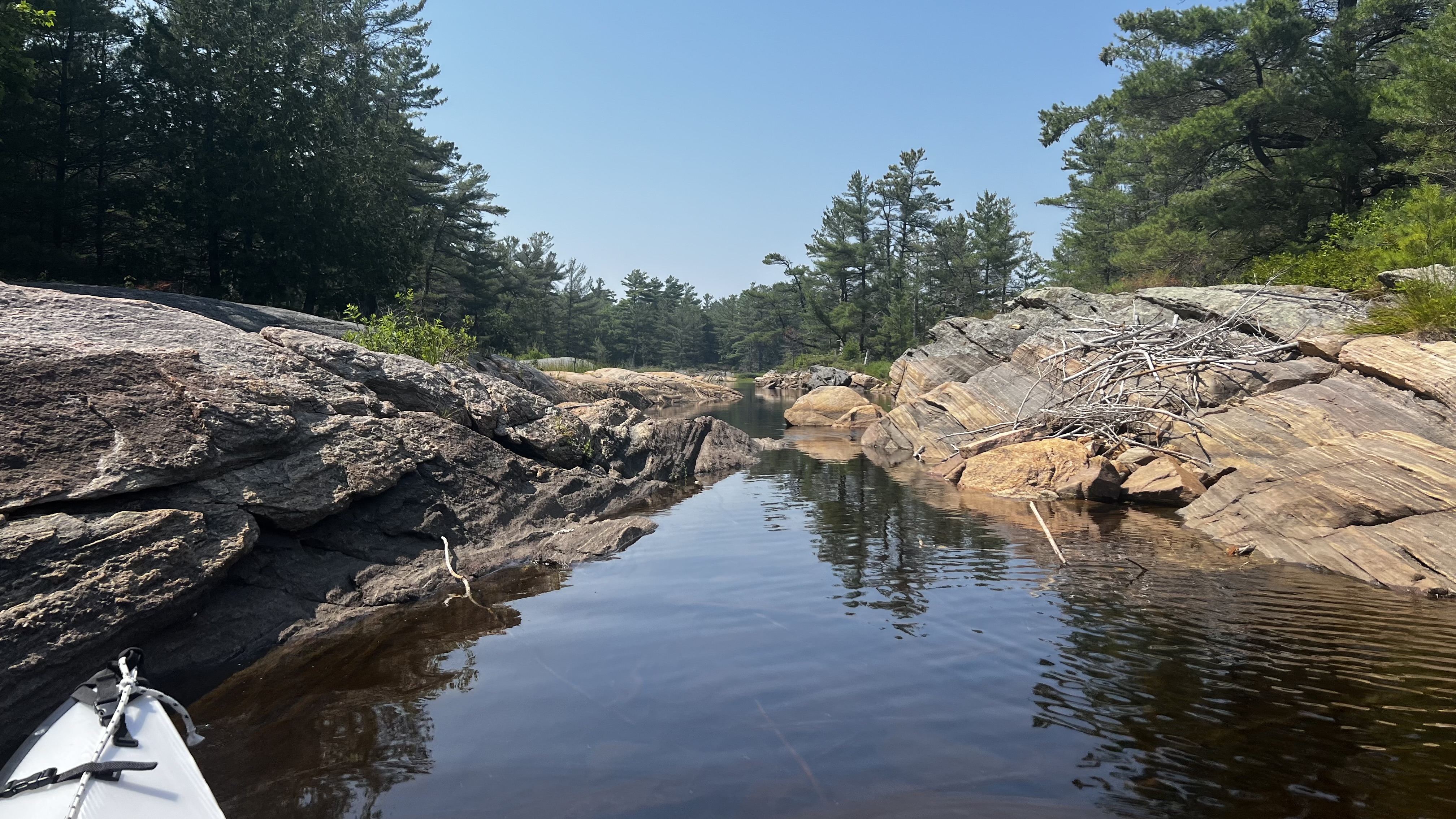
We explored with our Oru kayaks. (Here's a link to our first experience with these kayaks.) The island group is a genuine maze; even in the lower 2025 water levels there were always more channels to follow, always something around the next bend. All the boats anchored around us were equally quiet about it, as if everyone had silently agreed to protect the spell — right up until two large motorboats arrived mid-afternoon on our last day to raft up in the middle of the anchorage. Oh well, we were planning to leave the next morning anyway.
Pointe au Baril
Entering the Pointe au Baril Channel was straightforward — it's well buoyed and well-travelled. We anchored in Kitsilano Bay, a larger bay just south of the channel, and dinghied over to the Home Hardware and CCY General Store in Pointe au Baril. This place had a surprising range: fresh vegetables, groceries, hardware and a small chandlery — more than enough for a re-stock.
We shared a quiet night with five other sailboats. The first ten minutes of the next morning's passage, though, provided the most adrenaline of the entire week. We knew the Kitsilano Channel was narrow and shallow, so I stationed myself on the bow while Dave motored slowly. Unfortunately the water was heavily tea-coloured from recent rain and by the time I spotted the rocky ledge to port we had already kissed a rock — a bump to the keel before Dave quickly brought us to starboard. The lesson: stick to the recommended route on the chart and don't second-guess the soundings marked there, no matter how promising the depths look.
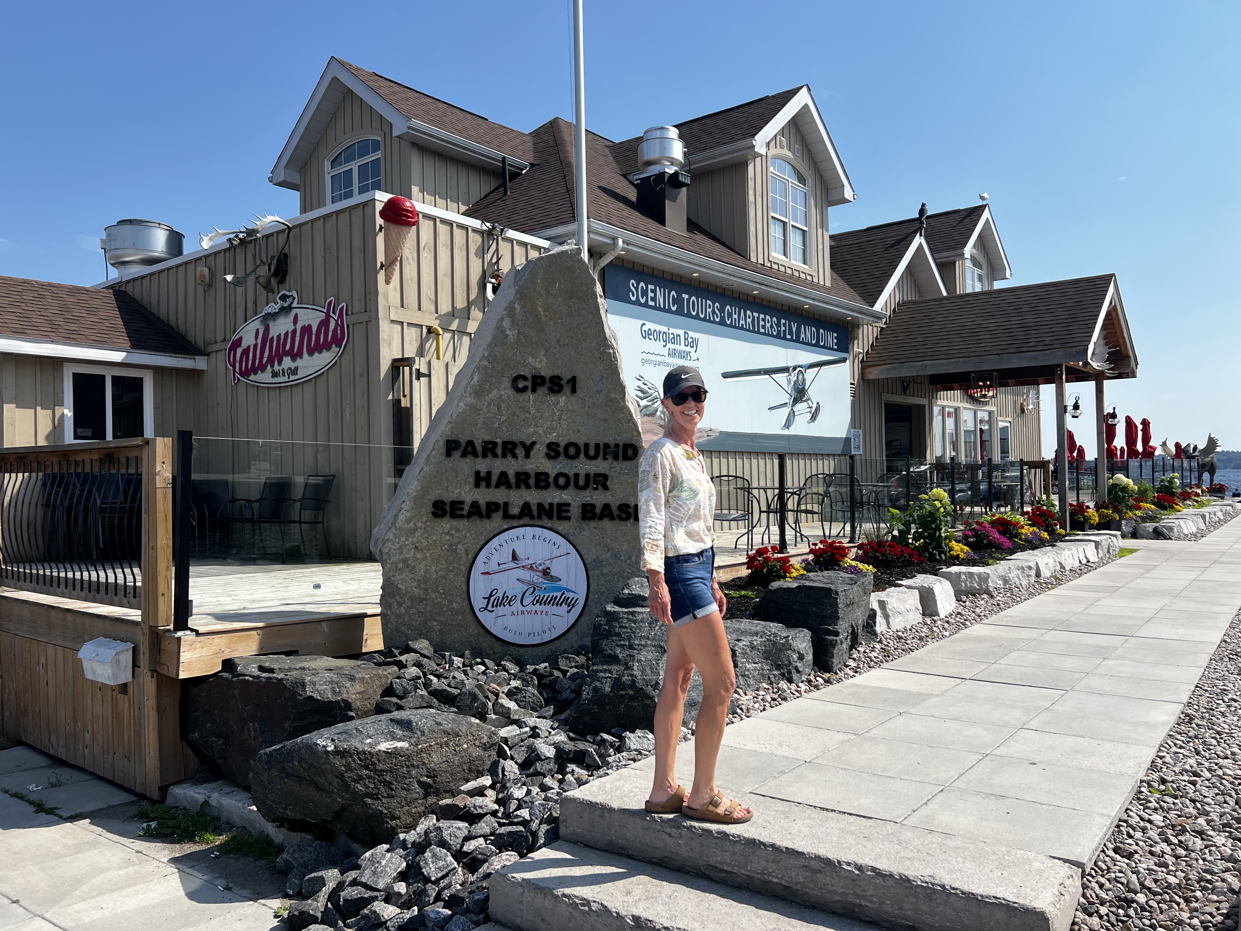
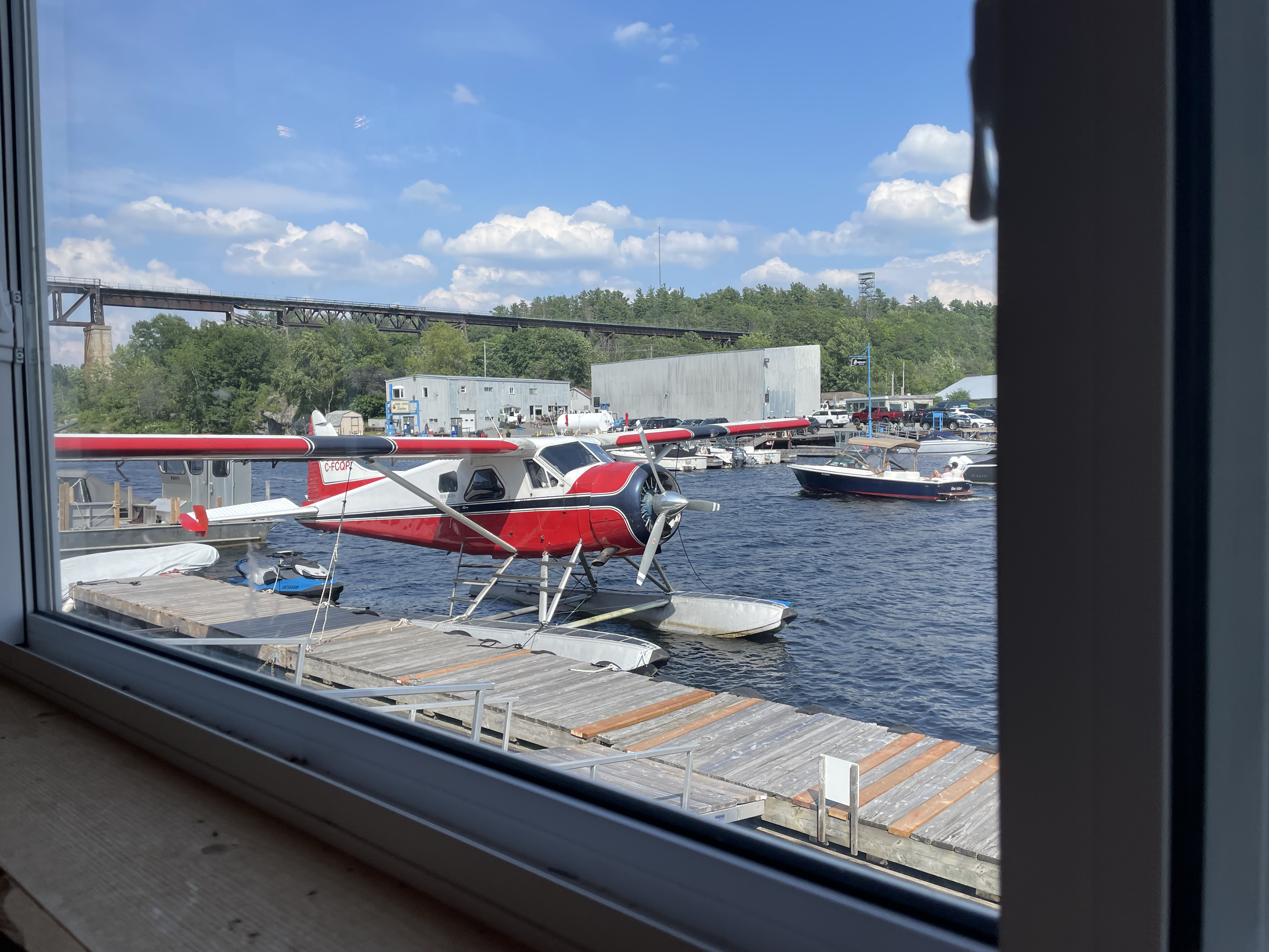
Parry Sound
After that gentle reminder we made our way down to Parry Sound for a week. Our friends and sailing instructor Rob and his partner Monica joined us for part of it, so basing ourselves at Big Sound Marina — with its parking and grocery access — made sense.
Parry Sound has everything a cruiser needs, though don't expect the grocery stores to be right at the dock. Both No Frills and Sobeys are near Highway 400 on opposite ends of town, about a 3-kilometre walk each way. Propane was easy: Georgian Bay Propane is right across the harbour from the marina, accessible by dinghy, next to Parry Sound Marine. On the way back from the shops it's worth stopping at the fruit and vegetable market on Bowes Street (corner of Albert), and the Trestle Brewery and Orr Meats are both right on the route. We also appreciated the waterfront restaurants and the Fitness Trail, which made for a great running loop from the marina. During the brutal heat we were grateful for a beautiful swimming and sunbathing rock just west of the marina — clear, clean water and easy access.
Kilbear and Franklin Island
We didn't wander too far from Parry Sound for anchorages, but made the most of what's close by. Kilcoursie Bay at Killbear Provincial Park is a large, clearly marked anchorage that gets busy on weekends. Holding is generally good in sand, though it can be tricky to get enough scope out with other boats around. Access to shore requires a day pass (our annual Ontario Parks pass covered us). The park offers great beaches, good protection from SW to N winds, and scenic rocks and hiking trails — though boat traffic near the swimmers is heavy, and quite a few reviews share that complaint.
Outer Regatta Bay on the south-east side of Franklin Island was probably our favourite in this area. The proper inner Regatta Bay is trickier to enter but buoyed; we opted for the outer bay this time, since the inner was full of larger motorboats and we didn't mind a bit more breeze. The outer bay has a small beach if that appeals, but for us the draw was two days of swimming, kayaking and good food with friends, surrounded by spectacular bare-rock scenery and a kayaker's paradise of channels. We'll be back.